Tag Archives: new york city weekend weather

NYC Easter Weekend Weather – Apr 14, 2017

The weekend ahead brings some of the warmest temperatures yet for the spring season as a summer-like weather pattern takes shape. The warm up will be short-lived, by Tuesday temperatures will be taking a dip below normal in the upper-50s.

Rest of today – mild, partly cloudy, with high temperatures in the mid-60s.

Saturday – increasing clouds, temperatures cooler in the low-60s.

Sunday (Easter) – very warm, high temperatures in the low-80s. Fog early, sunny otherwise, but with a chance for strong thunderstorms late in the day. A warm front will push through overnight Saturday, and a Bermuda high will take hold. This will lead to very warm air surging from the southwest and the Gulf of Mexico into this region.

Monday – not quite as warm as Sunday, but still quite nice with high temperatures in low-70s and mostly sunny skies.

NYC Weekend Weather – Apr 7, 2017

After a week of alternating days of wet and windy weather, we look ahead to improving conditions over the weekend and leading into next week. Sunny days with temperatures averaging anywhere between 5-10ºF above normal are right around the corner.

Rest of today – one of the last days of cooler than average weather we’ll see for a while. Temperatures hover in the low-50s with mostly cloudy skies. There is a chance for a passing shower with instability and moisture in the atmosphere from the backside of yesterday’s storm exiting east.


Saturday – skies clear, though temperatures remain below normal with high temperatures in the low-50s.

Sunday – a warm up begins as high pressure builds to the south of us. Clockwise flow around this high pressure brings warmer air in from the southwest. Temperatures warm into the mid-60s with sunny skies.

Monday – superb conditions for the Yankee’s home opener with sunny skies and high temperatures in the upper-60s to about 70ºF and sunny skies.


Drought Busted

The many rounds of rain we’ve seen over the course of the last couple weeks have finally busted the remaining drought conditions in the city itself and Long Island, just in time for the start of the growing season. Moderate drought still persists further north in the Hudson Valley.

NYC Weekend Weather – Mar 31, 2017

March ends on rainy note. It’s been a cooler and wetter month than average, after a much warmer February. The snow and rain has made significant positive impacts on the drought in this region. We get one good day this weekend, before more rain moves in to start the first week of April.

Rest of today – overcast, periods of rain, heavy at times due to a slow moving low pressure center. The heavier rains look to come later this evening into the overnight hours. Easterly and northeasterly winds will make it feel cooler than the high of around 40ºF.

Saturday – due to the slow pace of this storm, rain is still likely to be falling early tomorrow. High temperatures will remain well below normal due to the continued onshore easterly winds and cloud cover, only reaching the mid-40s.

Sunday – with the low pressure center finally exiting east, we should see dramatically improved conditions with highs rebounding to normal levels in the mid-50s and lots of sunshine.

Monday – starts off similar to Sunday with mostly sunny skies and temperatures in the mid-50s. Conditions deteriorate later in the day as the next storm system starts moving in.


Average Temperatures, Above Average Precipitation to Start April

Due to the influence of several storm systems forecast to impact the area, we’re expecting normal temperatures and above average precipitation to start the month off.

NYC Weekend Weather – Mar 09, 2017

Above average temperatures today give way to accumulating snow Friday. Very cold air then rushes in for the weekend, much along the lines of last weekend. This time around, cold air will persist, as a polar vortex is set to take hold of the East Coast. With this cold air in place, there is potential for a significant snowstorm in the form of a Nor’easter/coastal storm early to mid-week next week.

Rest of today – quite warm still with high temperatures remaining steady around the mid-50s. Breezy with west wind between 15-20mph under clear skies. Increasing clouds towards nightfall.

Friday – a rain/snow mix is anticipated to begin falling overnight, steadily transitioning to all snow by daybreak. This looks to be a messy commute. A cold front slides south of the area and a strengthening low pressure center moves along this frontal boundary, bringing us this snow. Due to warm temperatures in preceding days, snow will have a hard time sticking at first, but temperatures will remain cold enough throughout this event to yield likely snow accumulations of 3-5″.

Saturday – temperatures will remain well below normal as winds shift to the northwest following the passage of the cold front and storm system above. Breezy with winds around 15-20mph and decreasing clouds. High temperatures will struggle to hit freezing. Overnight lows leading into Saturday and then overnight into Sunday only in the teens.

Sunday – cold, sunny, with high temperature again barely at or above freezing. Spring forward occurs early Sunday, set your clocks ahead and get ready for more sunshine late in the day (not that it’ll help make things warmer right now).


Winter Not Giving Up – Possible Snowstorm Next Week

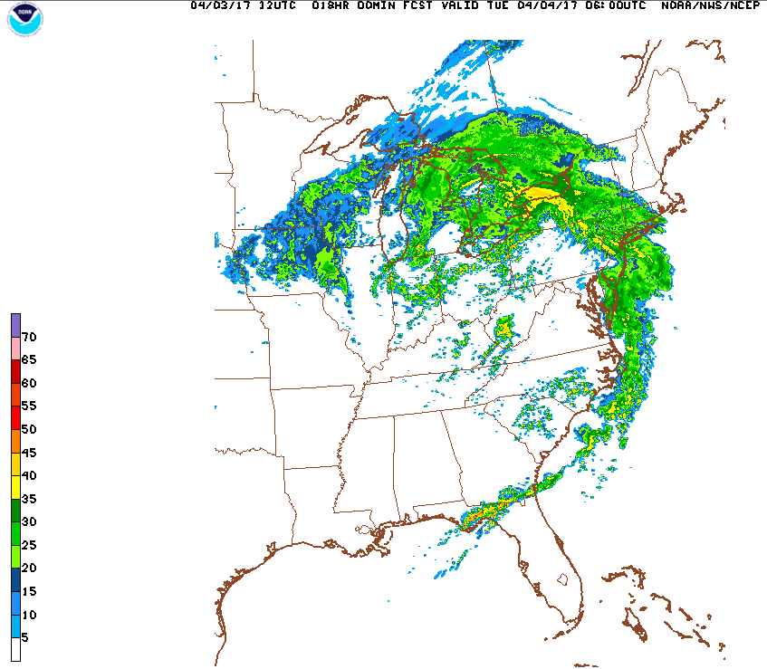
The predominant weather pattern thus far this winter has been one in which the jet stream has taken on an orientation that favors above average warmth over the eastern half of the US. Just as we turn the corner towards spring, it appears we are about to get slammed with a polar vortex and weather pattern more typical of February. While the cold itself will be enough to put a damper on spring, the real headline is the possibility for a significant late-season snowstorm in the form of a Nor’easter some time early to mid-week next week. Will keep you all updated on this as more data becomes available in the coming days.

NYC Weekend Weather – Mar 3, 2017

The record breaking warmth of only a couple days ago seems like ancient history. We could see some snow flurries to kick off the weekend, then a very cold airmass takes hold with temperatures well below normal. Another warm up is in store to start next week.

Rest of today – mostly sunny to clear skies to start. High temperatures near 40°F. Later in the day, and into the evening hours, an arctic front is forecast to pass through. Snow showers are anticipated to accompany this frontal boundary, though they should not result in any appreciable accumulation.

Saturday – behind the passage of this arctic front, winds shift to the northwest and pick up into the 15-25mph range, with stronger gusts. High temperatures will struggle to top freezing even with lots of sun, as overnight lows will be around 20°F. Wind chills will be in the teens or lower.

Sunday – overnight into Sunday, low temperatures are expected to drop into the teens. Sunny conditions prevail, with slightly warmer temperatures in the mid-30s.

Monday – a warm front will push through, finally breaking the spell of very cold weather. Temperatures should warm up into the upper-40s to near 50°F as clouds increase.

NYC Weekend Weather – Feb 24, 2017

Enjoy the spring like temperatures while they last. A strong cold front is set to pass through the area late Saturday. Behind this front, temperatures will return to the low-50s, and perhaps colder. Looking ahead for the next week or so, it appears we will see a cyclical pattern of warm weather ahead of storm systems followed by a rush of colder air.

Rest of today – mild, clear skies, high temperatures have already hit nearly 70°F. Overnight, temperatures drop into the low-50s.

Saturday – still quite warm, near 60°F, but with overcast skies and chances for precipitation ramping up through the afternoon hours. A line of moderate to heavy rain is expected to pass through sometime in the early evening hours. Some thunderstorms may be possible with this line of storms.

Sunday – behind this cold front Saturday, temperatures crash back to normal in the mid-40s wtih sunny skies.

Monday – slightly warmer, mostly sunny, with high pressure in control. High around 50°F.

NYC Weekend Weather – Feb 17, 2017

This weekend will be characterized by well above normal temperatures and fair conditions. This warm trend looks to continue into next week, and perhaps beyond. Enjoy the warmth, and the early preview of spring!

Rest of today – normal high temperatures around 40°F with sunny skies.

Saturday – significantly warmer, sunny, with high temperatures in the mid-50s as a warm front pushes through.

Sunday – warm again, possibly warmer than Saturday with temperatures approaching 60°F. High pressure to the southwest will continue to pump warm air from the deep south our way.

Monday – cooler, though still above normal, with high temperature around 50°F and sunny.


Warm Trend to Continue

Climate Prediction Center points to a high likelihood for above normal temperatures in the next 6-10 days for much of the Eastern United States. Looking ahead, after a brief cool down to begin next week, temperatures go right back up into the mid-upper 50s by the middle of next week.

NYC Weekend Weather – Feb 10, 2017

An eventful week of weather continues into the weekend, though not to the same degree of intensity. We will see another chance for snow, as well as rain this weekend. Temperatures rebound back to around or slightly above normal for the weekend. Looking ahead, there are some signals at another possible strong storm a couple weeks out, but it’s much to early to be certain.

Rest of today – cold, windy, sunny with areas of blowing snow. High temperatures below normal around 30ºF. Wind chills in the teens. Overnight tonight, we could pick up a light coating of fresh snow from a fast moving, and relatively weak storm system.

Below are some reported snowfall totals from yesterday’s coastal storm. As you’ll see, there was a fairly sharp cutoff between areas that received 9″ or more of snow. Long Island, Connecticut, and parts of the Hudson Valley got the largest totals. This was largely due to the fact that the most intense bands of heavy snow spent more time parked over these areas than it did in the city.

Saturday – conditions improving, along with warmer temperatures in the mid-40s under mostly cloudy skies.

Sunday – another storm system moves in from the Ohio Valley. This will bring a mixture of precipitation to the Northeast. Luckily, with high temperatures in the low-40s, we will see all rain.

Monday – winds pick up behind the departure of the storm system above, and skies should clear up as well. Temperatures should again be in the low-40s.


NYC Weekend Weather – Feb 03, 2017

The weekend starts of with a chill and below average temperatures before a warmup. Temperatures will be above average for the second half of the week. Next chance for precipitation will come with a storm system moving in Tuesday. Looking ahead, expecting that Punxsutaney will be right, and there will be a cooldown again.

Rest of today – clouds decrease slowly. Chilly with high temperatures struggling to hit freezing. Brisk northwest winds will keep windchills below 20ºF.

Saturday – with strong high pressure over the Ohio Valley, we’ll see clear skies. However, since we will be on the east side of this high pressure center, cold air will continue to flow in from Canada, keeping high temperatures at around freezing.

Sunday – as this high pressure moves east, and we end up on the west side of it, clockwise flow around it will bring warmer are to the area, and temperatures will rebound into the low-40s with mostly cloudy skies.

Monday – above average temperatures in the low-40s continue with partly cloudy skies.


Drought Improves

Recent beneficial rains and snows have improved the drought situation statewide. However, moderate to severe drought continues to plague the downstate region.

NYC Weekend Weather – Jan 27, 2017

The weekend period will see a gradual return to seasonably cold temperatures, a departure from the long stretch of above normal warmth we’ve seen the last week or so. A series of weak disturbances will move through the area, but these are not expected to bring much in the way of precipitation.

Rest of today – breezy with west winds of 20mph. Mostly cloudy with high temperatures in the low-40s. A weak disturbance brings a chance of snow flurries, but no accumulation is expected.

Saturday (Lunar New Year) – still above normal with high temperatures in the mid-40s and partly sunny. Not as windy as today, but with a strong low located over Labrador, westerly winds in the 15-20mph range will persist.

Sunday – high temperatures start to fall back to around 40°F. More clouds than sun.

Monday – colder, with high temperatures in the upper-30s and partly sunny skies.

Drought Update

The 1-2″ of rain we picked up during this past week’s Nor’easter, while beneficial, did little to change the drought picture as compared to last week.