The warm spell that we’ve enjoyed in the city up to this point will be ending tomorrow. While temperatures will cool off this weekend, we won’t be seeing anything close to the chilly lows we saw last weekend. We’ll have good weather Saturday before another cold front pushes through late Saturday into Sunday, which could spark off a few showers.
Rest of today – temperatures are surging into the mid-70s ahead of a cold front that will push through later today and overnight. There could be a small chance for showers associated with this cold front later, though it’s more likely this front will be dry.
Friday – high pressure builds behind this passing cold front. Cooler temperatures with highs only around 60 in the wake of this cold front despite plenty of sunshine.
Saturday – temperatures will be similar to Friday, but with clouds on the increase as another cold front approaches late Saturday. Some showers may occur with this cold front passing through overnight into Sunday morning.
Sunday – warmer with high temperatures in the mid-60s before the cold front passes. A chance of showers early, and the mostly cloudy.
Fall Foliage
This weekend should have good conditions for anyone traveling upstate apple picking or viewing fall colors. Check out this map to see where the foliage has peaked.
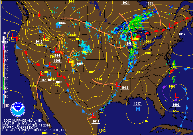
You can feel the chill in the air now. This cold will continue Saturday, but we’ll get a slight warmup Sunday and Monday ahead of a low pressure system moving in from the southwest. Behind that low pressure system, we get a reinforcing blast of arctic air that will be entrenched through the rest of next week. I’m also monitoring the potential for a Nor’easter just in time for the busy travel day Wednesday and through Thanksgiving.
Saturday – a cold day on tap despite ample sunshine. High temperatures will be generally in the lower 40s. There’ll be a noticeable northwest wind making it feel like it’s in the 30s.
Sunday – a milder day with warm air flowing in ahead of a low pressure system, but by warm, I mean highs only around 50. Clouds will increase throughout the day and there could be some rain Sunday night.
Monday – rain will be falling for the majority of the day, with highs in the city in the mid-40s. Monday night gets interesting with the potential for a rain/snow mix in the city, and all snow in interior regions north and west. Depending on the timing of the main slug of precipitation with this system, we could actually get some accumulating snow in the city also (the later in the night the main body of precipitation falls, the colder it will be, and the better the conditions for snow).Tuesday – cold air rushes back in behind this storm on Monday and we drop back into high temperatures hovering in the low 40s.
Potential Thanksgiving Nor’easter?
In looking ahead at the long-term GFS model output, I’m noting the possibility for a possible high-impact Nor’easter that would be timed to coincide with the busiest travel day right before and then during Thanksgiving. Of course, this far out, there’s still considerable uncertainty to the forecast, so this scenario could not pan out, or the storm track could be nowhere close to where it needs to be to produce a high-impact Nor’easter. Still, it’s worth watching, as it could be a major headache for folks if it does materialize.
I hope you all took advantage of this gift of incredibly warm weather that coincided with a federal holiday, because that’s going the be the last gasp of mild weather for at least the next 7-10 days. As you probably heard, we are going to get walloped by an arctic airmass the latter half of the week that will bring an abrupt end to fall temperatures and make it feel like we jumped straight into winter – I’m talking high temperatures that won’t even get out of the low 40s by week’s end. Before you ask, no this is not a polar vortex – it will be damn cold nonetheless.
Wednesday – this will be the last day we get above 60 degrees for quite a while. We are currently in a warm sector in between a warm front that pushed through earlier this week and ahead of a cold front that will be open the door to an arctic airmass swinging down from Canada. High temperatures in the Central Plains and Intermountain West where this airmass has already taken hold are ranging from the teens to the 30s. But Wednesday, we’ll still be in the mid-60s, although it won’t be as pleasant as today with a foggy and cloudy start to the day. Once the cold front below passes, clouds should clear quickly and lead to excellent conditions for radiational cooling, with low temperatures dropping into the low 40s and into the 30s in the interior areas north and west. Thursday – it won’t be that cold just yet, with high temperatures still expected to hit the low 50s. But clouds will again increase ahead of a second, quick-moving storm system that is expected to pass through Thursday night into Friday. This will be the real arctic sledgehammer that brings seriously cold air into the region. There will be enough energy and moisture in the atmosphere for the possibility of rain/snow mix on Thursday night and even all snow in the city Friday morning.
Friday – skies should clear quickly during the day Friday, but despite all the sun, temperatures will struggle to hit the mid-40s. Arctic air will be firmly entrenched from this point on until as long as Thanksgiving!
Saturday – High pressure will be in control Saturday, high temperatures will have a difficult time hitting 40 though, because the setup of the high will favor northerly winds. Sunday – yet another storm system brings us the chance for some precipitation. Behind that system – you guessed it, more cold air and temperatures that will be two standard deviations below normal for this time of year, as per our local forecast office.
For those of you who are interested in the long-term outlook, based on forecast models and the arctic oscillation index forecast, it looks like this blast of cold air will be sticking around with us for at least the next 7-10 days, and may not break until Thanksgiving. The Arctic Oscillation measures the climate pattern of winds circulating at high latitudes close to the arctic. When it is in it’s negative phase (as is about to be the case, on the right end of all the charts below), higher pressure tends to dominate over the arctic while lower than normal pressure occurs in mid-latitudes (i.e. our area). Air tends to flow from areas of high pressure towards areas of low pressure, so this pattern sets up favorable conditions for the intrusion of bitterly cold air into our region.
We get one last day of late summer-like temperatures today before autumn comes back with a vengeance. A cold front has already passed through the city and you can already notice the winds beginning to shift to the northwest. This will herald a much cooler temperature trend. For the remainder of today, we can expect temperatures near 70 with some clouds building behind the front. There could be a sprinkle or two but nothing serious.
Sunday forecast map
Sunday will be noticeably more cold with high temperatures struggling to hit the mid-50s and with a gusty northwest wind. Gusts could top 30mph at times with sustained winds 15-25mph. Overnight lows into Sunday and Sunday night will be downright chilly in the 40s. Some interior areas could see frost Sunday night.
Monday the winds will abate as the pressure gradient between the departing cold front and high pressure to the west eases. Temperatures will remain cool at only around 60.
Tuesday and into later this week we will see the impact of a frontal system that moves through from the Great Lakes and develops as a coastal low off the Mid-Atlantic. Current models seem to suggest that this low will linger for a few days offshore, so we could see multiple rounds of rain as bands rotate around the storm center.
Winter Climate Outlook
The Climate Prediction Center has released its 3 month temperature and precipitation long range outlooks for the months ahead. As you will see, CPC has the NYC area in a zone of 33% chance of seeing a wetter and warmer than average winter. Call it a hunch, but I still think we’ll get a couple nasty Nor’easter type blizzards. Warmer than average of course doesn’t imply we won’t get freezing temperatures. A slightly warmer atmosphere would allow for more moisture and energy for coastal storms to feed off.
Today marks the first day of astronomical autumn, and it has been feeling ever more fall-like the past few days.
Wednesday – the day should start off partly cloudy, and high temperatures will sit at right about 70. However, with a coastal low forming off the Mid-Atlantic, cloud cover will increase especially later in the day.
NAM high resolution model output for Thursday, 9/25 @ 11AM EDT.
Thursday – a slow moving coastal low (technically a Nor’easter) will be moving over the NYC region during the early morning hours Thursday and throughout the course of the day itself. With the low pressure center just to our south or southeast, we should see a cool northeast wind off the ocean. This will limit high temperatures to only the upper 60s under cloudy skies and periods of rain.
Friday – with this coastal low out of the way, high pressure will take control again and clear the way for a superb start to the Rosh Hashanah weekend. Highs on Friday should bounce back nicely into the mid 70s under clearing skies.
GFS model output for Saturday, 9/26
Saturday – high temperatures will continue climbing to nearly 80 on Saturday under clear skies.
Sunday – pretty much a carbon copy of Saturday. High near 80.
The next chance at rain will be next Tuesday with a cold front approaching us from Canada.


