After a week of gloomy, cloudy, and at times rainy weather, we will get a nice break this weekend as conditions improve. The same high pressure that’s caused Hurricane Florence to make landfall on the Carolinas by blocking its northward progress will bring us sunnier weather. Indeed, some of the cloud cover over our area is actually a result of outflow from Florence. Its remnants will impact us with rain at some point early next week.
Rest of today – mostly cloudy with high temperatures in the mid-70s as winds continue from the east. High surf with waves 8-12 feet are possible at the coast due to Florence.
Saturday – decreasing clouds as high pressure continues to build. High temperatures around 80ºF.
Sunday – sunny, high near 80ºF, high pressure remains in control.
Monday – clouds and the chance for rain returns. More moist air returns as the high pressure that gives us nice weather over the weekend slides east (and the flow on its western side starts to bring moisture from the south up). We’ll need to monitor the progress of the remnants of Florence as they are likely to bring us rain.
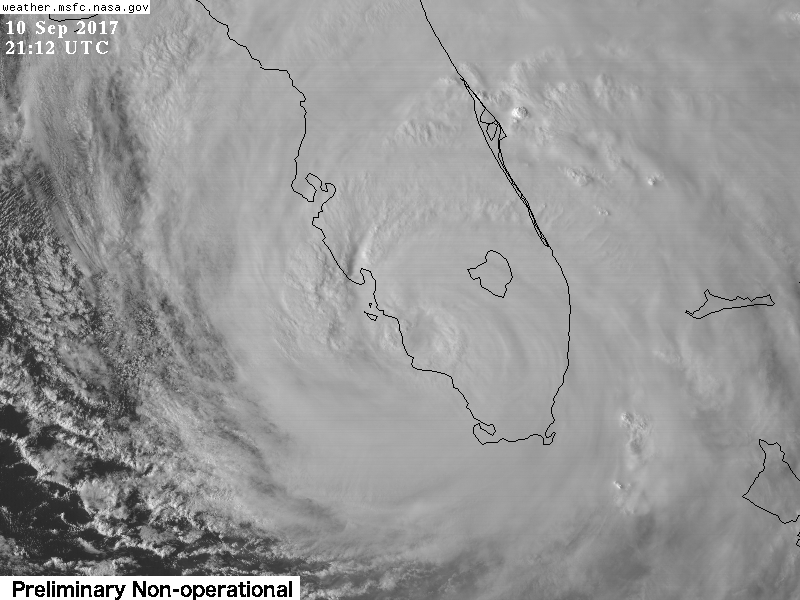
This week kicks off with a prolonged period of unsettled weather as a warm front and a cold front both impact the area. Chances for rain will be with us through Wednesday. Conditions finally improve late in the week. We luckily will avoid direct impacts (aside from high surf) from what will be an extremely dangerous Hurricane Florence, which looks set to make landfall on North Carolina late this week. Aside from Florence, two other storms pose threats to US territories this week.
Rest of today – cloudy, with periods of rain, heavy at times, especially later in the day towards the overnight hours. High temperatures will be in the upper-60s with cool, persistent onshore flow from the east. Ahead of an approaching warm front.
Tuesday – chances for thunderstorms will persist into Tuesday, with this slow-moving warm front finally pushing through. There could be thunderstorms overnight. Then, later in the day, as the trailing cold front moves through. Once the warm front passes over, we’ll be within the warm sector of the parent low pressure system, which will allow temperatures to climb into the low-80s with a marked increase in humidity.
Wednesday – the cold front mentioned above will slow down as it approaches us and dissipate. This will lead to continuing chances for rain, and thunderstorms with temperatures again in the low-80s.
Thursday – high pressure will finally begin to build in to our north by Thursday behind the cold front above. This will lead to better conditions, with partly sunny skies and temperatures in the low-80s.
Friday – partly sunny skies with high temperatures in the low-80s again with high pressure to our north.
Florence, Isaac, and Olivia All Pose a Threat to the US
These three storms have the potential to impact the Southeastern US, Puerto Rico, and Hawaii respectively within the next week. Among these, Florence is by far the most dangerous, as it could make landfall on North Carolina as a Category 4 storm with maximum sustained winds of 145 mph.
Hurricane Florence
Over the past day or so, the picture for Florence has become much clearer. Various forecast models have come into remarkable alignment on both the overall track and intensity of Florence over the next 5 days, which means bad news for the Carolinas. The picture looks grim, with Florence set to make landfall as a very strong Category 4 storm packing sustained winds of 145 mph. Florence has nothing but warm water ahead of it, and there should be minimal impact ot this storm from vertical wind shear. Even if the storm weakens due to eyewall replacement cycles prior to landfall, that would only serve to increase the radius of its damaging winds. No matter how you slice it, Florence is likely to bring deadly storm surge and risk of life-threatening flash flooding and inland flooding. The fact that its forecast track slows to a crawl after landfall makes the flooding risk inland especially serious.
Hurricane Isaac
Isaac is a compact storm, which is leading to some uncertainty regarding both its track and intensity forecast. Small tropical cyclones are subject to wild swings in intensity both ways, which can be unpredictable at times. As of now, Isaac is forecast to cross the Windward Islands of the Lesser Antilles as a Category 1 storm, then continue into the Caribbean where hostile shear conditions should cause it to weaken. It is worth noting, despite the UKMET model being an outlier, that there are some signals that the storm could turn to the northwest later in the period, which could mean a threat to Hispaniola and Puerto Rico.
Hurricane Olivia
This storm continues to track towards Hawaii. Although weakening due to the influence of moderate wind shear, it is still set to hit Hawaii later this week as a strong tropical storm. The primary threat to Hawaii from Olivia will be in the form of heavy rain and flash flooding regardless of whether it makes direct landfall on one of the main islands.
A brief break in the heat over the weekend has led back into another warm spell to begin this week. This latest blast of heat will be short-lived as a backdoor cold front sweeps through tomorrow, followed by another, stronger cold front later this week. Temperatures for the upcoming weekend will once again be comfortable, seasonable to below average. In the tropics, things are starting to get busy with tropical storms Florence and Gordon active and another tropical wave poised to become a tropical cyclone off the coast of Africa. Gordon will make landfall overnight on the Gulf Coast east of New Orleans.
Rest of today – hot and humid with temperatures in the low-90s, mostly sunny skies.
Wednesday – cooler, though still warm with high temperatures in the upper-80s and partly sunny skies. A backdoor cold front will bring cooling onshore southeasterly breezes that help keep a lid on temperatures.
Thursday – temperatures rise back a couple degrees into the low-90s ahead of an approaching cold front from the northwest. The warm air ahead of the cold front could help set the stage for a few scattered strong thunderstorms as the front passes through.
Friday – temperatures cool off quite a bit into the low-80s under mostly cloudy skies. Chance of showers during the day with the cold front lingering south of the area.
Tropics Heating Up
We have 2 active tropical cyclones (Florence, Gordon), and another incipient one in the Atlantic Basin. Tropical Storm Gordon could strengthen into a hurricane before landfall on the Gulf Coast between Mississippi/Alabama overnight into Wednesday. Heavy rain could induce flash flooding in southern portions of these states. The immediate coastline will be at risk of storm surge flooding. Florence doesn’t pose an threat to land. The disturbance shown below that’s furthest east is a tropical wave that’s just emerged off the coast of Africa. This is worth watching as it has a high chance of becoming a tropical cyclone and its eventual track could pose a threat to portions of the Lesser Antilles.
Hurricane Maria will not be coming our way this week. The cold front that will be responsible for pushing Maria out to sea arrives late in the week and induces a return to fall weather. Until then, it will continue to look and feel like summer.
Rest of today – warm, sunny, high temperatures well into the mid and upper-80s
Tuesday – some patchy fog over night. Any fog should burn off early and high temperatures should reach in the low-80s with mostly sunny skies.
Wednesday – could see some more clouds, and possibly some rain along a frontal boundary passing through. High temperatures in the low-80s.
Thursday – clouds and sun with temperaturea around 80°F.
Hurricane Jose will be the primary weather maker for us in the NYC region during the beginning of the week. Tropical storm watches are up for almost the entire the Northeast coast, except for NYC itself. The storm is expected to continue weakening, and while landfall on the US mainland is not expected, there will still be plenty of impacts from the storm.
Monday – isolated chance of showers, primarily this morning. Highs in the mid-70s with cloudy skies.
Tuesday – showers likely from the bands of what will probably a low-end Hurricane Jose or high-end tropical storm. Due to the track of Jose, it will look and feel much like a Nor’easter, with steady winds from the northeast between 15-20 mph. High temperatures in the low-70s. These winds will peak overnight into Wednesday around 25 mph.
Wednesday – rain is still possible from the influence of Tropical Storm Jose. Temperatures in the mid-upper 70s. Winds from the north between 20-25 mph.
Thursday – much more pleasant as Jose moves away from us and continues to weaken. Mostly sunny with high temperatures in the upper-70s.
Hurricane Jose
Hurricane Jose has been exhibiting signs of weakening over the past few days. In this latest satellite image, you can see the center of circulation is exposed and the primary convective areas are well to the north. This is due to strong mid-level wind shear from the south. The storm is also about to leave the warm waters of the Gulf Stream. Both these factors should continue to lead to steady weakening.
As the storm weakens, it has expanded in size, so despite its center not being forecast to make landfall, it is still expected to bring significant coastal impacts (beach erosion, coastal flooding, high surf) along with heavy rain.
As a side note – Hurricane Maria also bears watching with the potential to affect the East Coast next week.
We will start this week that marks the 16th anniversary of the 9/11 attacks with excellent and seasonably warm temperatures in the low-80s for memorial services today. The pleasant weather should hold up through Thursday before the remnants of Irma begin to move into the region. Looking ahead, some forecast models have hinted that Hurricane Jose poses a possible risk to the East Coast.
Rest of today – pleasant, mild conditions with mostly sunny skies and high temperatures in the low-80s.
Tuesday – mostly sunny skies again with high temperatures much the same as today in the low-80s. High pressure will be in control of our weather during this period.
Wednesday – clouds begin to build in conjunction with the northward movement of the expansive cloud shield associated with Irma well to the south. This will cause temperatures to dip just a bit to about 80°F.
Thursday – a touch warmer, mostly cloudy skies, high temperatures in the low-80s.
Hurricane Irma and Jose Updates
Residents of Florida’s west coast avoided what looked like it could be a worst case scenario for them. Irma weakened faster than forecast and moved just far enough inland such that the strongest winds of the eye did not hit Tampa. The weaker storm also reduced the risk of serious storm surge. Still, as you’ve probably seen from media reports, damage from the storm is widespread and of varying degrees of severity across the state. The dangers of the storm now move inland, with heavy rain and tropical storm winds into the Southeast.
While Irma spins down over the Southeast, Jose remains a wildcard for the East Coast next week. Several runs of the GFS have suggested a landfall for Jose somewhere in the Mid-Atlantic or Northeast. It’s far too early to know with any degree of certainty whether this scenario will pan out, since a lot of other forecast models show Jose curving out to sea, but it will bear watching.
Hurricane Irma has made landfall on the mainland of the Florida Peninsula at Marco Island. The eye is directly over Naples as of the time of this post. As the winds start to shift to the west and southwest in areas south of the eye of Irma, destructive storm surge will rapidly become a serious threat to life and property. The storm has weakened somewhat to a strong Category 2 with 110 mph winds. This does not diminish the wind threat, or the storm surge, flooding rain, and tornado threat.
Current Situation
Irma’s eye has filled in again as it’s interacting with Florida. It is a large, powerful storm which easily covers the entire state of Florida. There are still widespread reports of hurricane force wind gusts along the east coast of Florida, despite the eye being on the opposite side of the state.
Headlines
Storm surge has been flooding the streets of Miami all day. The storm surge threat will become very dangerous for southwest Florida in the next couple hours as the eye moves north along the west coast of Florida. This will bring onshore winds from the west and southwest and push the ocean over land.
Onshore winds along northern Florida and the Georgia/South Carolina coasts tonight will bring a storm surge risk there as well.
Wind threat is less serious than it was when Irma was still a strong Category 4, but a 110 mph Category 2 storm is still serious. Wind gusts recorded at Naples reached 142 mph. The northern eyewall is packing the biggest punch and this will continue to advance north along the west coast of Florida.
Next cities in line for a beating will be Fort Myers, Port Charlotte, and then the Tampa Bay area.
Tornado warnings have been popping up along the east coast of Florida with some of the stronger bands of Irma.
Forecast Track
It is pretty clear now that Irma will continue north to just west of north as it traverses the state of Florida along its west coast. Tampa Bay is the largest city at risk along this path.
Forecast Intensity
Irma is still expected to maintain hurricane strength until Monday. It should pass over Tampa Bay as a strong Category 2 storm. It will continue to gradually weaken during the next 48 hours followed by more rapid weakening.
Hurricane Irma made landfall traversed the Florida Keys overnight as a powerful 130 mph Category 4 storm. As suspected, it was able to re-strengthen slightly over the warm waters of the Florida Straits. Landfall on the southwest coast of Florida somewhere near Naples is imminent. The forecast track is a worst case scenario for Tampa Bay, which could experience a direct hit from Irma’s eye as a Category 3 storm.
Current Situation
As of 11AM, Irma was a Category 4 storm with max sustained winds of 130 mph. It was located in the Gulf of Mexico between Key West and Naples and moving north or north-northwest.
Headlines
Landfall on southwest Florida will occur this afternoon as a Category 4. Devastating wind damage is expected.
Storm surge will occur on the southwestern side of Irma. As of now, offshore winds from the north side of Irma are pushing water out to sea. This water will return as a storm surge once winds shift to onshore on the backside of the storm.
Devastating winds impacts are expected for Tampa Bay with this forecast track. This will be the first direct impact of a hurricane of this magnitude in Tampa Bay since 1921.
Heavy, flooding rain is expected across Florida as well as much farther inland in the Southeast.
Forecast Track
Forecast models are tightly clustered on a solution that takes Irma right up the west coast of Florida. This puts the cities of Naples, Fort Myers, Port Charlotte, and Tampa Bay at high risk of experiencing the worst winds from Irma’s core.
Forecast Intensity
Irma is expected to weaken as it moves up through the coast of Florida. However, it will still be a dangerous Category 3 or strong Category 2 storm when passing Tampa Bay. It will also likely bring strong winds to large parts of Georgia.
Hurricane Irma is moving away from the north shore of Cuba and entering the very warm waters of the Florida Straits. While it’s still moving west-northwest, it is still anticipated to finally make a turn towards the northwest as it’s rounding the southwestern periphery of the high pressure over the Atlantic that has steered it up to this point.
Current Situation
Irma’s eye shows some signs of organization and clearing up. The National Hurricane Center still pegs the storm as a Category 3 storm with 125 mph winds. As outlined in previous posts, the land interaction with Cuba has produced adverse effects on Irma, disrupting its core and causing it to weaken. However, now that it is clearing the island of Cuba and into the open waters of the Florida Straits, it should still have a window to re-intensify before hitting Florida.
Headlines
Forecast models are converging on a solution that takes Irma just inland and parallel to the west coast of Florida after a landfall near Marco Island.
First landfall could occur somewhere between Key West and Marathon Key.
Fort Myers, Cape Coral, Naples, Port Charlotte, and the Tampa Bay area are under serious risk of a direct hit from the eye of Irma, which could regain Category 4 strength. Storm surge is a major concern for the west coast of Florida and the southwest of the state in particular.
Miami and the South Florida region are less at risk from the worst of the winds, but other hazards like flooding, storm surge, and tornadoes persist. Again, the strongest winds of a hurricane in the northern hemisphere occur on the eastern side of the storm, which will impact the east coast of Florida.
Should the track of Irma inland but near the coast bear out, this would likely result in a slower decline in the hurricane’s strength. It would bring more risk of inland hurricane impacts to Georgia.
Forecast Track
Forecast Intensity
The National Hurricane Center forecast does call for some moderate re-intensification of Irma prior to landfall in Florida. This forecast calls for sustained winds of 140 mph prior to landfall. There are no inhibiting factors to the storm re-intensifying once it gets over open water. Wind shear is low. Sea surface temperatures are very warm.
Uncertainties
Internal fluctuations in the storm could still interrupt any re-strengthening.
On the other hand, there is a small chance for some rapid intensification if the storm gets organized again.
Since model forecasts haven’t changed since earlier today, this lends higher confidence to a track along the west coast of Florida.
Overnight, Irma made landfall on the Cuban Keys off the north shore of Cuba. Land interaction with Cuba has eroded Irma’s circulation to the point where it is now a marginal Category 4 storm containing 130 mph peak sustained winds. However, it would be unwise for anyone in Florida to dismiss this storm for reasons discussed below.
Current Situation
Irma has been downgraded to a marginal Category 4 storm with peak sustained winds at 130 mph. Despite only barely touching the Cuban coast, it’s clear from satellite imagery that land interaction has disrupted Irma’s circulation. The eye is no longer clearly visible. The western side of the storm looks ragged.
Headlines
Track forecasts continue to shift slightly westward from overnight. This lowers the risk for a direct hit by the eye of the storm in the Miami area. However, since the strongest winds in a hurricane in the northern hemisphere occur on the east side of the storm, Miami can still expect strong wind impacts.
Hurricane force winds extend 70 miles from the eye on each side. Tropical storm force winds are 400 miles in diameter with this massive storm.
The risk to the west coast of Florida continues to increase. Southwest Florida could see the worst storm surge with surge of 6-12′ forecast.
It is not out of the question that Tampa Bay could take a direct hit from the eye of this storm at Category 3 strength.
Irma could still re-intensify over the very warm waters of the Florida Straits once it moves away from Cuba.
Tornadoes in the bands of Irma as it moves north will pose a limited but dangerous threat.
Forecast Track
The high pressure over the central Atlantic that has steered Irma to this point continues to remain strong enough to keep it on west-northwest motion along the northern coast of Cuba. Based on this latest track forecast, it is possible that Tampa Bay takes a direct hit from Irma. Portions of the Florida Panhandle are also at increasing risk. This track also enhances the risk of inland impacts in Georgia and southeastern states.
Forecast Intensity
Irma has been weakened by interaction with the north coast of Cuba. It is now a marginal Category 4 storm with sustained winds of 130 mph. While some further weakening is possible, once Irma emerges over the very warm waters of the Florida Straits, weakening should cease. It could even re-intensify over these waters before making landfall. Keep in mind that Category 3 winds would still be very serious.
Uncertainties
Any further motion into Cuba would mean further degradation to the storm’s core and circulation which could result in more weakening.
There is a window for some possible re-strengthening over the Florida Straits.
An eyewall replacement cycle could still occur bringing fluctuations to the strength of the storm.
The exact timing of Irma’s turn north is still not certain. When it turns north will have large implications for who sees the worst direct wind impacts from the eye of the storm.