Tag Archives: weekend weather

NYC MLK Jr. Weekend Weather – Jan 18, 2019

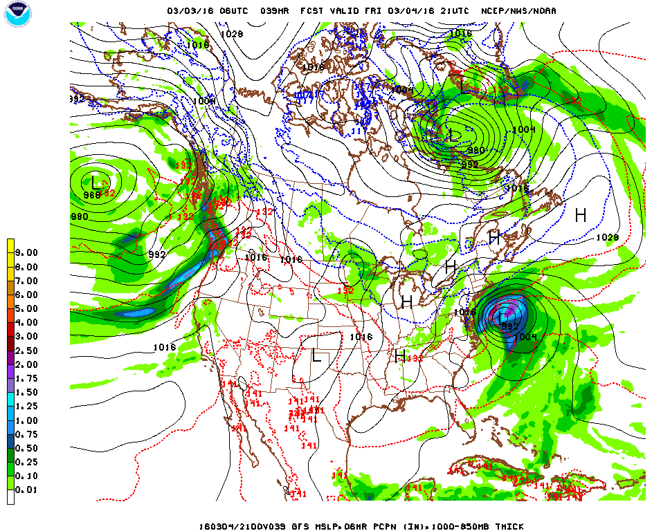
The dusting of snow we got last night into today is just a small preview of what lies ahead this weekend. A major storm, that first brought heavy rain to the west coast, has been tracking across the nation and will impact the region late Saturday through Sunday with potentially a mixed bag of everything from snow, sleet, freezing rain, rain, urban street flooding, coastal flooding, and strong winds that could result in power outages and tree damage (esp. if ice accumulates). Behind this storm, the coldest air of the new year surges in, bringing a bitterly cold start to next week. I’ll post an in-depth forecast of the incoming winter storm tomorrow.

Rest of today – the veritable calm before the storm. High pressure briefly establishes itself behind the weaker disturbance that brought us light snow overnight. Skies slowly becoming partly cloudy. High temperatures in the low-40s. Overnight lows colder around 30°F.

Saturday – should start off as a decent day with partly cloudy skies. Cloud cover increases through the day, and snow starts to spread from southwest to northeast during the late afternoon hours. High temperatures in the mid-30s. Overnight lows right around freezing will critically impact how much snow accumulation we get before what is widely expected to be a transition over to wintry mix of sleet and freezing rain, then finally bouts of heavy rain leading into Sunday. If a warmer scenario plays out, we’ll get less snow and ice, and more rain. Various forecast sources call for between 1-4″ of snow and sleet accumulations, with up to as much as 0.10″ of ice.

Weather Prediction Center surface forecast for 7AM Sunday. A real mixed bag of various precipitation types all along the Mid-Atlantic and Northeast

Sunday – high temperatures will continue to play a pivotal role Sunday in determining precipitation type. Some forecast sources suggest colder high temperatures in the mid-30s, while others remain warmer, in the upper-30s to even 40°F. There is broad agreement that the day starts off with plain rain but then transitions back to wintry mix of sleet, freezing rain, and finally snow. The differences in high temperature will be pivotal to the timing of this transition, with a warmer scenario keeping things all rain longer. As the center of the low responsible for the storm moves off to the north and east, it will continue intensifying and the pressure gradient around it will increase quite dramatically. Robust northwest winds are expected to develop, rapidly advecting cold, Arctic air into the area. The intensity of this cold advection will govern how quickly temperatures start to plummet during the second half of Sunday. It would appear that temperatures will be well below freezing by the late afternoon hours. This prompts concerns for a flash freeze of any standing water or untreated surfaces, leading to dangerous travel conditions. Temperatures will continue dropping overnight Sunday, with overnight lows going into Monday only around 10°F. Overall, this forecast shapes up to be a slushy mess, with a layer of snow coated by ice and sleet, melted by rain, but then re-frozen with an additional light layer of sleet and ice before all is said and done.

Weather Prediction Center’s plot of ensemble forecast low tracks/positions. Note that there’s still decent uncertainty even at this stage approaching the storm. The pink cluster denotes storm center positions by 7AM Sunday. Though they seem closely clustered, even a shift of the storm track 25-50 miles north or south could result in big differences in terms of whether locations at the coast receive more snow and frozen precipitation (southerly track) versus more of a rain event (northerly track).

Monday (MLK Day) – if you have the day off, count yourself lucky, because this is shaping up to be a brutally cold day where temperatures topping out in the upper-teens despite ample sun. Continued windy conditions will produce wind chill values below zero. The bitter cold continues into Tuesday morning with overnight lows again in the low-teens.

NYC Weekend Weather – Feb 9, 2017

Cold start to this weekend gives way to a milder feel but a soaker of a day Sunday. Going into next week, much of the week will see above average temperatures.

Rest of today – increasing low-level clouds associated with warm air advecting from the south ahead of a warm front. Temperatures still on the cool side during the day with high temperatures in the mid-30s.

Saturday – overnight temperatures actually start to rise as warm advection really takes hold. High temperatures will substantially warmer near 50°F. Cloudy with increasing chances for rain as a cold front approaches from the west.

Sunday – the cold front above will stall in our vicinity, with tropical moisture surging along this frontal boundary. This will result in multiple rounds of moderate to heavy rain. Temperatures will be in the low-50s.

Monday – cooler but still decent with decreasing clouds and high temperatures in the mid-40s.

NYC Weekend Weather – Aug 4, 2017

A hot week transitions into a weekend that will see the end of the heat and humidity for at least half of next week and maybe longer. Rain and thunderstorms dot the forecast except appropriately Sunday.

Rest of today – partly sunny with high temperatures in the mid-80s. The rain and thunderstorms this morning give way to a dry day otherwise.

Saturday – a warm front moves through overnight into the morning with a cold front following right on its heels. This will bring a period thunderstorms producing heavy rain at times. Marginally favorable atmospheric conditions could spawn a few strong storms. Clouds clear up in the afternoon and highs are expected to reach normal levels in the mid-80s.

Sunday – cooler, drier air moves in behind the cold front Saturday. High pressure builds to the south and west and moves south sending cooler Canadian air around its periphery towards us. High temperatures will be comfortable around 80°F with lots of sun.

Monday – a weak disturbance brings rain and cooler temperatures, well below average only in the mid-upper 70s.

Trouble in the Tropics?

A vigorous tropical wave has spun up off the west African coast and Cabo Verde. Storms originating from this region have historically been some of the most powerful and damaging, but that’s if they can sustain the transit across the Atlantic. The National Hurricane Center has this wave at a 50% of forming into a tropical depression or storm in 2 days, and 80% chance in 5 days. It’s worrying that it’s starting to get picked up on long-term GFS model runs taking a swipe at the US East Coast as a strong tropical cyclone, however, this far out, it’s difficult to say which one of many scenarios could play out. It does bear monitoring though.

GFS for Wednesday 8/16, with the tropical system in the picture right off the East Coast of the US.

NYC Weekend Weather – Oct 28, 2016

This weekend we will see a brief warmup in temperatures. Saturday will have the best weather, with another round of rain likely for later in the day Sunday. Temperatures dip back below normal Monday to start off next week.

Rest of today – it’ll be a mostly sunny day. However, a tight pressure gradient around the low pressure and storm system that brought us moderate to heavy rain yesterday will result in stiff winds from the northwest. Temperatures will be below normal in the upper-50s.

93fndfd_init_2016102800

Saturday – a very pleasant day on tap with temperatures bouncing back nicely into the low-60s, not too much wind and mostly sunny skies.

Sunday – a cold front will be draped from west to east across the Northeast and push through late Sunday. Temperatures ahead of the frontal boundary will be quite mild in the low-70s with mostly cloudy skies. We get another chance at much needed rain with this frontal passage.

screen-shot-2016-10-28-at-9-16-19-am

Monday – temperatures fall back into the upper-50s as a result of the cold front passing through Sunday. Mostly sunny skies though.


NYC Weekend Weather – Sept 22, 2016

Today marks the official start of astronomical autumn, even though it will feel anything but fall-like today. Temperatures cool off considerably this weekend, which will lead us into a period of average to below average temperatures for the next week or so.

Rest of today – warm with high temperatures in the low-mid 80s and sunny skies.

Friday – warmer still with high temperatures in the mid-upper 80s and mostly sunny skies. Small chance for showers overnight as a cold front encroaches from the west.

Saturday – with the aforementioned cold front swinging through, we will get a noticeable change in airmasses from a more humid, tropical influence we’ve felt the last few days, to a drier, cooler, continental airmass from Canada. The resulting swing in temperatures will be dramatic, with high temperatures on Saturday ranging 10ºF lower than Friday in the mid-70s.

screen-shot-2016-09-22-at-10-07-11-am

Sunday – one of many sunny, fall-like days coming with temperatures in the low-mid 70s.

Monday – almost a clone of Sunday, sunny with highs in the low-70s.

NYC Weekend Weather – Sep 16, 2016

Yesterday was the Mid-Autumn Festival, a traditional harvest festival celebrated by many cultures in East Asia. It certainly felt more fall-like yesterday with below average temperatures after we spent one day near 90ºF on Wednesday. The fall weather continues this weekend, with a chance for some much needed rain Sunday.

Rest of today – crisp and cool with high temperatures below normal in the low-mid 70s.

Saturday – a bit warmer, with temperatures a couple degrees above normal under sunny skies, in the upper-70s.

Sunday – ahead of an advancing cold front, we could see showers, thunderstorms, and heavy rain, particularly in the afternoon. high temperatures will warm up a little ahead of this front, into the low-80s under mostly cloudy skies.

screen-shot-2016-09-16-at-1-32-54-pm

Monday – since the frontal boundary won’t pass through until late in the day, there’s a lingering chance for showers with high temperatures hovering around 80ºF.


NYC Weekend Weather – May 20, 2016

If there ever was an ideal day to play hooky from work or school, today would be the day. As it turns out, it’s also National Bike to Work Day, and you couldn’t ask for better weather for this. This weekend will be a mixed bag though, with rain developing later on Saturday and possible Sunday. Looking ahead, a Bermuda High sets up in the next week and will push temperatures above normal.

Rest of today – picture perfect conditions, mostly sunny, high temperatures in the mid-70s.

Saturday – mostly cloudy with rain developing in the afternoon and evening hours. A low pressure system offshore to our south will be the cause of this rain, though the heaviest rain likely won’t make it onshore. High temperatures cool off into the mid-60s with cloud cover and winds moving from southeast to north as the low progresses.

Screen Shot 2016-05-20 at 9.03.57 AM

Sunday – a lingering chance for rain in the morning, followed by mostly cloudy conditions, but slightly warmer with high temperatures in the upper-60s.

Monday – small chance for showers in the afternoon, high temperatures again in the upper-60s with mostly cloudy skies.


Finally Warming Up – Drought Development Likely

The development of a Bermuda high in the 6-10 day range will result in above normal temperatures for much of the Northeast, as you see from the following charts from the Climate Prediction Center. While we’re all yearning for warmer temperatures with the cool spring we’ve had, the warmth and lack of rain will be conducive for the development of drought conditions this spring. We had just recovered from a persistent, though only moderate drought this winter, but we’re way behind in terms of precipitation averages for this time of year.

610temp.new season_drought

NYC Weekend Weather – Mar 10, 2016

Another day of near record or record breaking temperatures is on tap for the region as a highly anomalous stretch of warm weather continues. Yesterday, Central Park hit 77ºF, shattering the old record of 69ºF set in 2000 by nearly 10ºF. Looking ahead, temperatures will moderate somewhat over the weekend, but will remain 10ºF+ warmer than normal for this time of year in the upper-50s to low-60s. We spring forward an hour into Daylight Savings Time on Sunday.

Rest of today – temperatures at this hour were already well into the upper-60s and just over 70ºF across the region. Today would easily be warmer than yesterday if not for the fact that current satellite trends suggest that widespread cloud cover will be moving in over the next couple of hours. Areas that experience more breaks in cloud cover today could break some records. Rain will develop, first to the north, then push through the whole area overnight tonight.

Screen Shot 2016-03-10 at 9.41.52 AM

Friday – clouds should clear up steadily through the day Friday. A cold front will move through, and will cause high temperatures to dip by about 10ºF compared to today, yielding highs in the low-60s, but that will still be over 10ºF above normal for this time of year.

Saturday – high pressure from the north takes control and gives us a beautiful, sunny day with high temperatures near 60ºF.

Sunday – similar temperatures to Saturday, but with increasing clouds as the next storm approaches the area.

Monday – cooler with high temperatures in the low-50s and rain.

Warm Trend Continues to Late March

Looking ahead, temperatures are forecast to continue at above normal levels through the majority of March.

610temp.new 814temp.new

NYC Weekend Weather – Mar 3, 2016

As we approach spring, the weather has a tendency to swing wildly between different extremes. We start this forecast period off with accumulating snow, while by this time next week, we are expecting temperatures in the 60s!

Rest of today – mostly sunny, but cool with below average high temperatures in the upper-30s.

Friday – overnight tonight into the first half of Friday, our area will get impacted by the northern fringe of what is expected to be a powerful coastal storm. Lucky for us, high pressure north of us is sufficiently strong so as to prevent this storm from hitting us dead one, which would certainly result in a more significant snowfall event. In this case, we are expecting to see snow in the range of 1-2″ across the city and Long Island with lesser amounts further north and west. Temperatures will remain colder than nom

Screen Shot 2016-03-03 at 10.17.46 AM


StormTotalSnowWeb1

Saturday – high pressure takes control with skies clearing and temperatures in the low-40s. Another slight chance for snow Saturday night accompanies the passage of a clipper system.

Sunday – partly sunny with highs around average in the low-mid 40s.

Monday – temperatures start to warm up as the high pressure moves offshore to the east and warm, southwesterly return flow circles clockwise around its western periphery. High temperatures in the low-50s.

Warming Trend Ahead

With the aforementioned high pressure center offshore in the Atlantic early to mid-week next week, we’ll see increasingly warm temperatures, up into the 60s by Wednesday. This warm trend looks to continue over the course of the next week, with a brief cooldown late next week before what should be a warm weekend next week.

610temp.new 814temp.new

NYC Weekend Weather – Feb 26, 2016

The main weather story this weekend will be a rather dramatic swing in temperatures. We start the weekend off with below normal temperatures and highs only in the upper-30s. By Monday, temperatures are forecast to reach into the mid-50s. The best day of the weekend will be Sunday with ample sunshine and mild highs in the low-50s.

Rest of today – sunny, with a cool northwest wind in the 20-25mph range, which will make it feel like the upper-20s with an actual high temperature in the upper-30s.

Saturday – winds abate and but temperatures remain cool in the upper-30s despite plenty of sunshine.

Sunday – a world of difference with temperatures topping out in the low-mid 50s.

High pressure to the south with a frontal boundary to the west leads to warmer air flowing from the southwest

Monday – continuing a mild trend with temperatures in the mid-50s and mostly sunny skies.