As we approach spring, the weather has a tendency to swing wildly between different extremes. We start this forecast period off with accumulating snow, while by this time next week, we are expecting temperatures in the 60s!
Rest of today – mostly sunny, but cool with below average high temperatures in the upper-30s.
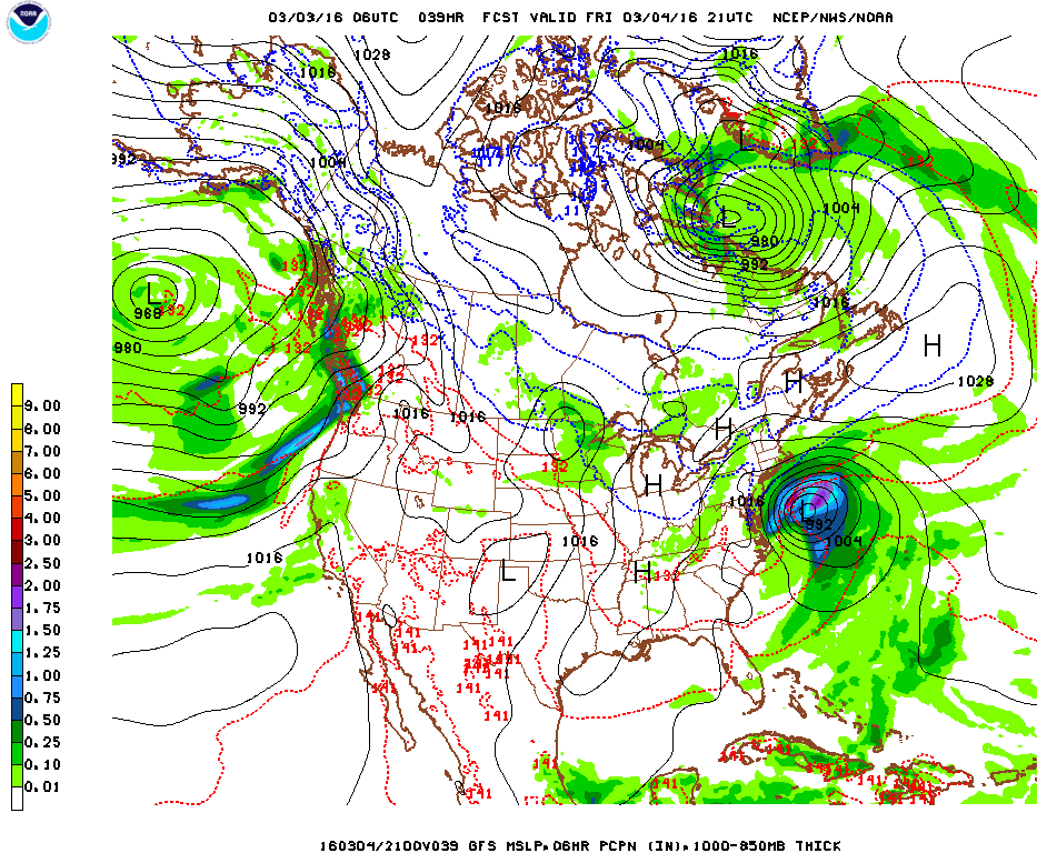
Friday – overnight tonight into the first half of Friday, our area will get impacted by the northern fringe of what is expected to be a powerful coastal storm. Lucky for us, high pressure north of us is sufficiently strong so as to prevent this storm from hitting us dead one, which would certainly result in a more significant snowfall event. In this case, we are expecting to see snow in the range of 1-2″ across the city and Long Island with lesser amounts further north and west. Temperatures will remain colder than nom


Saturday – high pressure takes control with skies clearing and temperatures in the low-40s. Another slight chance for snow Saturday night accompanies the passage of a clipper system.
Sunday – partly sunny with highs around average in the low-mid 40s.
Monday – temperatures start to warm up as the high pressure moves offshore to the east and warm, southwesterly return flow circles clockwise around its western periphery. High temperatures in the low-50s.
Warming Trend Ahead
With the aforementioned high pressure center offshore in the Atlantic early to mid-week next week, we’ll see increasingly warm temperatures, up into the 60s by Wednesday. This warm trend looks to continue over the course of the next week, with a brief cooldown late next week before what should be a warm weekend next week.

