The groundhogs were unanimous in their proclamation of an early spring, but do their predictions jive with climate forecasts? Either way, the first week of February will be an active one with multiple storms impacting the area. Temperatures are forecast to start much above normal in the mid-50s, then taper down to being a touch above normal in the low-40s. Most of the precipitation that falls should be in the form of rain, though overnight periods could produce mixed precipitation.
Rest of today – Early clouds should give way to more sunny skies later in the day. High temperatures will be mild, in the mid-50s as a stationary front slowly lifts north as a warm front into the overnight hours. Overnight lows in the low-40s.
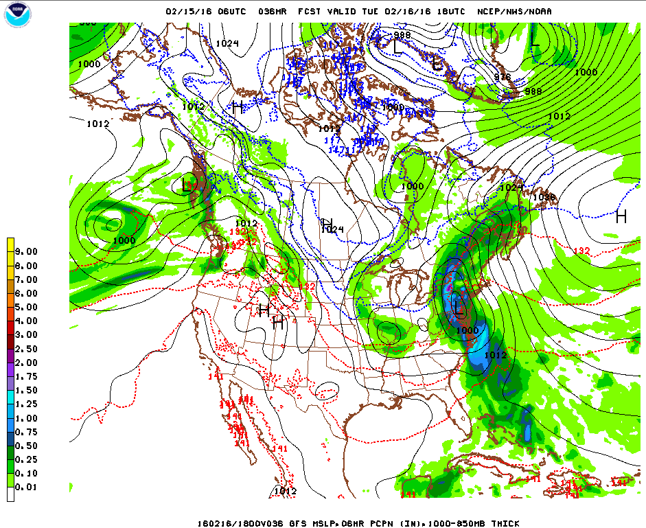
Tuesday – High temperatures in the low-50s. The warm front mentioned above stalls out, then returns as a cold front. This pattern brings the potential for some light rain showers. Overnight lows in the low-40s.
Wednesday – high pressure builds in briefly, and should give us some reprieve from rain, however, north winds will cool things off with highs in the low-40s. Overnight lows drop into the low-30s as a second, stronger storm system takes aim at the area. This one could start off as wintry mix and sleet overnight for NYC.
Thursday– any accumulation of wintry mix should get washed away as this second storm system lingers and produces rain during the course of the day Thursday. Mostly cloudy otherwise as highs climb into the low-40s. Temperatures currently forecast to remain steady for the most part overnight with onshore flow.
Are the Groundhogs Right? Climate Prediction Center’s temperature outlooks for the second half of February and the entire month suggest that the groundhogs might be on to something – at least for the eastern part of the US (especially the southeast), where above normal temperatures are being forecast. That isn’t as much the case for the western US, as you can see below.
Climate Prediction Center temperature outlook for Feb 8-12
Climate Prediction Center temperature outlook for Feb 10-16
Climate Prediction Center temperature outlook for the whole month of February
The dusting of snow we got last night into today is just a small preview of what lies ahead this weekend. A major storm, that first brought heavy rain to the west coast, has been tracking across the nation and will impact the region late Saturday through Sunday with potentially a mixed bag of everything from snow, sleet, freezing rain, rain, urban street flooding, coastal flooding, and strong winds that could result in power outages and tree damage (esp. if ice accumulates). Behind this storm, the coldest air of the new year surges in, bringing a bitterly cold start to next week. I’ll post an in-depth forecast of the incoming winter storm tomorrow.
Rest of today – the veritable calm before the storm. High pressure briefly establishes itself behind the weaker disturbance that brought us light snow overnight. Skies slowly becoming partly cloudy. High temperatures in the low-40s. Overnight lows colder around 30°F.
Saturday – should start off as a decent day with partly cloudy skies. Cloud cover increases through the day, and snow starts to spread from southwest to northeast during the late afternoon hours. High temperatures in the mid-30s. Overnight lows right around freezing will critically impact how much snow accumulation we get before what is widely expected to be a transition over to wintry mix of sleet and freezing rain, then finally bouts of heavy rain leading into Sunday. If a warmer scenario plays out, we’ll get less snow and ice, and more rain. Various forecast sources call for between 1-4″ of snow and sleet accumulations, with up to as much as 0.10″ of ice.
Weather Prediction Center surface forecast for 7AM Sunday. A real mixed bag of various precipitation types all along the Mid-Atlantic and Northeast
Sunday – high temperatures will continue to play a pivotal role Sunday in determining precipitation type. Some forecast sources suggest colder high temperatures in the mid-30s, while others remain warmer, in the upper-30s to even 40°F. There is broad agreement that the day starts off with plain rain but then transitions back to wintry mix of sleet, freezing rain, and finally snow. The differences in high temperature will be pivotal to the timing of this transition, with a warmer scenario keeping things all rain longer. As the center of the low responsible for the storm moves off to the north and east, it will continue intensifying and the pressure gradient around it will increase quite dramatically. Robust northwest winds are expected to develop, rapidly advecting cold, Arctic air into the area. The intensity of this cold advection will govern how quickly temperatures start to plummet during the second half of Sunday. It would appear that temperatures will be well below freezing by the late afternoon hours. This prompts concerns for a flash freeze of any standing water or untreated surfaces, leading to dangerous travel conditions. Temperatures will continue dropping overnight Sunday, with overnight lows going into Monday only around 10°F. Overall, this forecast shapes up to be a slushy mess, with a layer of snow coated by ice and sleet, melted by rain, but then re-frozen with an additional light layer of sleet and ice before all is said and done.
Weather Prediction Center’s plot of ensemble forecast low tracks/positions. Note that there’s still decent uncertainty even at this stage approaching the storm. The pink cluster denotes storm center positions by 7AM Sunday. Though they seem closely clustered, even a shift of the storm track 25-50 miles north or south could result in big differences in terms of whether locations at the coast receive more snow and frozen precipitation (southerly track) versus more of a rain event (northerly track).
Monday (MLK Day) – if you have the day off, count yourself lucky, because this is shaping up to be a brutally cold day where temperatures topping out in the upper-teens despite ample sun. Continued windy conditions will produce wind chill values below zero. The bitter cold continues into Tuesday morning with overnight lows again in the low-teens.
The track of the imminent nor’easter and blizzard has continue to trend west of earlier model runs. This has introduced increasing uncertainty as to overall snowfall totals along the immediate coastal areas along with possible wintry mix/freezing rain. On the other hand, confidence is increasing in heavy snow for areas north and west of the city, with snowfall totals 18″+ looking likely.
Impacts – heavy snow north and west of the city, snowfall accumulations in the interior 16-20″+ looking likely. Sharp gradient in the heaviest snowfall totals approaching the coast where wintry mix, freezing rain, and even plain rain could mix in during the early afternoon Tuesday. The exact location of the extent of warm air intrusion off the ocean will ultimately determine the difference between routine totals over 1 foot and areas that receive much lower snowfall totals. The difference in some cases could be a matter of mere miles. This line could fall in and around NYC itself. Still expecting a period of blizzard or near blizzard conditions for NYC during the course of this storm even if a transition to mixed precipitation does occur. Snowfall totals could still pile up close to a foot or over prior to this transition. The possibility of freezing rain and ice introduces an additional hazard on the roads and when coupled with strong winds of 30-35mph and gusts 45mph+ could result in power outages.
Timing – light snow should begin to fall early into the overnight hours, progressively growing in intensity. In the city, overnight accumulations of 3-6″ possible, with a sharp increase in totals north and west. Heavy snow with sleet and wintry mix during the morning and early afternoon in the city, all snow in points north and west. Blowing and drifting snow with blizzard conditions possible. Snow begins to wind down during the evening hours.
Caveats – any further movement of the storm track west would result in drastically lower snowfall totals for NYC and points east along the coast. Correspondingly, an eastward shift of the storm track would put NYC itself squarely in the bullseye for the heaviest snows.
The latter half of this week will bring welcome relief from a period of below average temperatures. Temperatures will rise well into the 50s by the end of the week. Winter returns for the weekend as temperatures fall back to seasonal levels.
Rest of today – there are some light snow showers far west of the city. Some of this might make it to the city, with a chance for snow and wintry mix and a high around 40ºF.
Wednesday – overnight, temperatures barely drop, while a storm system moves through. A chance of wintery mix transitions to all rain by daybreak. Rain ends by the early morning hours and
Thursday – a second storm system moves through Wednesday night into Thursday, with high temperatures rising well into the mid-50s. Mostly cloudy skies will prevail.
Friday – more clouds than sun, with high temperatures dropping back a bit to about 50ºF.
After a brief deep freeze, we’ll see a significant change in the weather with a complex storm system that will affect the area to start the week, bringing a mix of precipitation along with much warmer temperatures. Things quiet down by mid-week, and temperatures moderate towards more normal levels.
Rest of today – cloudy with temperatures rising into the low-mid 30s. Flurries have already begun falling in some parts of the city. Snow will become more steady and increase in coverage during the course of the afternoon. For those of you who do not have the day off, it’s shaping up to be a messy commute with snow transitioning to a wintry mix, with periods of freezing rain during the evening commute. Prior to the transition from snow, areas along the coast could pick up 1-2″ of snow, with higher totals in the interior north and west.
Tuesday – after a brief dip in temperatures early on during the overnight hours, temperatures will actually start increasing as a warm front passes through. Since the ground itself is still quite cold due to the deep freeze this past weekend, freezing rain and wintry mix will still be lingering around until temperatures start to climb well into the mid-upper 30s. At that point, we’ll transition over to all rain, and periods of moderate to heavy rain will likely affect the area Tuesday afternoon into the evening hours as a cold front pushes through. Temperatures will be very warm Tuesday, with highs topping out in the mid-50s – 15-20ºF above normal for this time of year.
Wednesday – high pressure starts to build back in after the storm system moves out Tuesday. Temperatures cool off back into the mid-40s, with clearing skies.
Thursday – cooler, with high temperature around 40ºF and sunny skies.
Another messy start to the work week is in store for us tonight and into Monday night as we endure a long duration, though relatively light intensity winter storm. Luckily for us, the storm track means we’ll avoid the worst impacts of heavy snow (New England will get the worst of it again). There’s some concern for icing again, although the impact should be slightly less serious than last Monday. The rest of the week will be precipitation free, with the exception of some snow showers possible Thursday. Following these snow showers, another shot of brutally cold Arctic air is expected by week’s end, such that highs will only be in the low 20s and even upper teens.
Monday – as you can see from below, the snowfall totals for the southern portion of the NYC area are on the very low end, only 1-2″ expected in NYC and in Long Island. The higher snowfall totals will be north of I-84 and into Connecticut, with the far northern suburbs getting a chance at over 6″. Bear in mind, the snow is expected over an extended period starting tonight through Monday night.
Storm total snow forecast
Ice is a bigger concern for the immediate coastal areas that will see less snow. High temperatures during the day Monday be below freezing, so freezing rain is expected and could deposit between 0.15″-0.25″ of ice when all is said and done. The majority of this is expected to fall Monday morning before temperatures cool off at the coast and precipitation switches back to all snow.
Storm total ice forecast
Tuesday – high temperatures should be right around freezing with clouds diminishing through the day as the storm system from Monday pulls to the east.
Wednesday – a sunny day expected with highs again near freezing.
Thursday – we get our next chance at snow, on the light side, with a passing low pressure system forming over the Great Lakes and moving east towards us high temperatures will be again around freezing.
Friday – a sunny, but frigid day with highs expected to only be in the upper teens and low 20s. As you can see from the chart above, to the west of the low affecting our area on Thursday, there is an area of high pressure which will usher in that reinforcing blast of Arctic air.
We got a bit of a (cold) respite during the weekend from any precipitation, but all that is about to change in a big way tonight and into tomorrow. A complex storm system that is set to bring snow across a wide swath of the Midwest will be approaching the area tonight and into tomorrow. Various factors make this storm even harder to forecast than the Nor’easter last week, including a still uncertain storm track and a very tight temperature gradient leading to the potential for a mixed bag of all precipitation types in the NYC region.
Impacts
This storm is set to make Monday a downright nasty day to be out. Snow is forecast to begin falling tonight, with areas to the north of the city expected to pick up the most snow through this storm. During the AM rush, temperatures are expected to rise just enough in the lower atmosphere to allow for the possibility of sleet, ice pellets, and a period of freezing rain along the coast near the city, with rain possible further east in Long Island. Then, to close out the day, temperatures will drop rapidly below freezing, such that any slush or melted snow or wet surfaces could flash freeze. Because the temperature gradient is so tightly packed, it will again literally be a matter of miles between a spot that picks up mostly snow and perhaps 8″+, and another location that picks up almost no snow, but gets a significant coating of ice.
Ice accumulation forecast – anything over 0.10″ can cause serious problems.
Snowfall total forecast – note the similarity with the last storm as to how dramatically snow totals range across a very small geographic area.
Below are some probabilistic forecast graphics that will give you a good sense of the degree of uncertainty within this storm forecast. First, with respect to snowfall totals over the next 48 hours.
Probabilities of greater than 2″ of snow
Probabilities of snow accumulation greater than 4″
Probabilities of greater than 8″ of snow
Here’s the same time window, but with probabilities for ice accumulation.
Probability of ice accumulation greater than .10″
Probability of greater than .25″ of ice accumulation
In the snowfall probability maps, you can see just how tightly packed the different bands of probability for snowfall are. A matter of 50 miles means the difference between being in an area of 40%-50% probability of receiving more than 4″ of snow, and an area with a greater than 80% chance of receiving the same total.
Timing
Snow will begin to fall later this evening and pick up in intensity overnight. Depending on the area you’re living in, you could see between 3″-8″ overnight, with the highest totals most likely north of the city, and the lowest totals along the coast and in eastern Long Island. Around the morning rush, areas along the coast and eastern Long Island should begin to see a transition from snow to freezing rain, or some type of wintry mix of ice pellets and sleet. Some parts along the coast may even see a changeover from rain/snow to plain rain. In the afternoon, temperatures will drop quickly below freezing, allowing for flash freezing of slush and other wet surfaces. Winds will begin from the east initially before turning northeast and then north through the day.
Why the Uncertainty?
The reason behind the complexity of this storm with respect to precipitation types, uncertainty of total snowfall amounts, rests with storm’s track and the dynamics in the lower atmosphere accompanying this storm. This storm, unlike a Nor’easter, has its genesis over the Central Plains. However, as it approaches the coast, it will still be able to pick up a good amount of moisture off the ocean and from points south.
Recalling that air around a low pressure center in the northern hemisphere in a flows in a counterclockwise motion, you can better understand what is going on here. The low pressure center is forecast to pass just to our south. To the north of the storm center, colder air will dominate, since the cyclonic flow would be pulling air from north to south. Meanwhile, on the south side of the storm center, warmer air is being wrapped into the storm from the south and east. This onshore flow bringing relatively warmer air in close proximity to colder (sub-freezing) air is the reason why there is such a dramatic range in forecast snowfall totals across the area, and also the reason why there is a possibility for a range of different precipitation types.
Above is a forecast map that shows the forecast position and track of the storm. The colored points represent the individual forecast ensemble members (different forecast models with slightly different inputs) predictions for the storm. Notice that there is still a nontrivial spread between these ensemble members. You may also observe that they seem to cluster to the north of the official forecast track (the black line). Indeed, forecasters have been making slight northward adjustments in response to this trend. Should this bear out, and the low pressure center does move a bit further north, we would end up with less snow, more chance for mixed precipitation and even rain. On the opposite end, if the storm track deviates south, we would get more snow, and less chance for mixed precipitation. A very tricky forecast indeed!
All eyes turn towards the imminent Nor’easter that will be bringing significant winter weather impacts to the NYC metro region. Many variables remain unresolved that could affect the eventual outcome, but at this time, it looks like we’re in for a nasty combination of freezing rain, rain, and snow during the day Saturday. At present, forecasts call for somewhere between 2-4″ of snow in the city along with some ice accumulation. Precipitation should fall as all snow north and west of NYC, however, overall accumulation should be slightly less than in the city itself since the most intense precipitation will remain near coastal areas.
Friday – we get a pleasant, sunny, and slightly above average day with high temperatures in the mid-upper 30s.
Saturday – a tricky forecast for Saturday. What we know for sure, with different forecast models in relatively close agreement, is that an area of low pressure now forming over the Texas Gulf Coast will track over the Southeast, and then offshore of North Carolina by Friday night/early Saturday. Once the low moves offshore, it will rapidly intensify, and then track right on or very close to the 40ºN 70ºW benchmark by Saturday afternoon/early evening.
The uncertain part about this scenario has to do with the thermal profiles in place. With no high pressure over us or to the north pumping in cold Canadian air, the depth of cold (sub-freezing) air will be relatively shallow.
As the Nor’easter approaches us, the cyclonic flow around its center will wrap in some relatively warmer air in from the ocean and points south. This makes for a complicated picture – with warmer air aloft (see animation below) during parts of the day, and below freezing air nearer to the surface throughout points in the day, the recipe is set for at least some periods of freezing rain – precipitation that falls as rain, and then freezes on contact with a sub-freezing surface.
During the middle portion of the day, temperatures should be warm enough at the surface to support plain rain for some time, before transitioning back into freezing rain, rain/snow mix, perhaps with a period of all snow before tapering off Saturday evening.
NAM output of temperature profiles at about 4,800 feet between 10AM and 7PM Saturday. Notice the light pink indicating temperatures between 0ºC and 10ºC, which only gives way to below freezing temperatures (light blue, indicating 0ºC to -10ºC) later in the time frame. The center of the Nor’easter is located within the middle of the set of concentric rings you see near NYC.
Deviations in the storm track to the east would result in more cold air being pulled in from the action of northerly winds on the western side of the low pressure center’s cyclonic flow (less freezing rain/rain, more snow), while deviations of the track west would result in warmer air being in place (less snow, more rain). So, even a slight adjustment in the storm track could alter the thermal profiles, and subsequently what kind of precipitation we see.
Sunday – temperatures overnight Saturday will be below freezing, which would allow anything that fell and melted to refreeze. Things do clear up Sunday, with highs about average in the mid-30s, and with clouds diminishing.
Monday – there is a chance for yet another round of mainly snow, potentially heavy, as another coastal storm is possible. Highs will be close to the freezing mark, making this an all snow event if it should pan out.


