Overnight, forecast models shifted the track of the ongoing Nor’easter further west. This has implications for snowfall totals across the region.
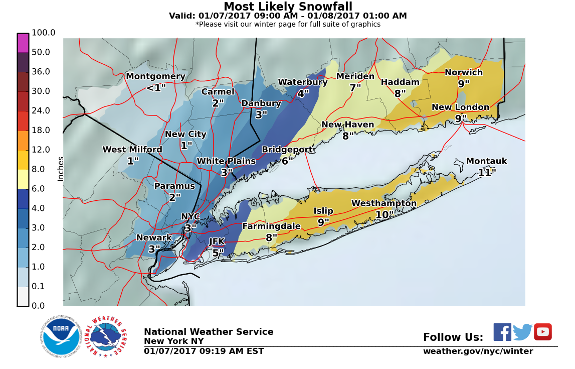
Snowfall Totals
These have been bumped up for the city, which is now expected to receive 2-5″. The potential exists for more. Winter storm warnings now extend as far west as Nassau County, with points further east receiving as much as 7-12″.


As always with Nor’easters, even as they are ongoing, considerable uncertainty remains a factor. With these storms, one or more banding features will develop and circulate around the center of the storm as it progresses northeast. The number, extent, intensity, and western limit of advancement of these banding features ultimately determines what areas get the most snow. Within these bands, snowfall rates could easily reach 1-2″/hour. West of the western limit of the progression of these bands, snowfall totals will drop precipitously, such that a distance of 10 miles could mean the difference between 2″ and 6″+.
Timing
You can already see the radar signatures of two bands of moderate to heavy snow spawned by this storm. One of these bands is currently pushing its way west through Long Island, while another progresses towards shore. Within these bands, travel conditions will rapidly deteriorate while accumulations rack up.

Looking ahead to this afternoon, it would appear that the heaviest snow will fall in the city around 2PM, or the early afternoon.
