Monthly Archives: November 2014

NYC Weather – Pre-Thanksgiving Storm Back On

It’s hard to believe now, with air temperatures still hovering around 60 at this hour on Monday, that by Wednesday, our entire region could be looking at accumulating snow! Over the weekend, it has become clear through progressive model runs that the mid-week storm that on Friday looked like it would miss us, is tracking to hit us on Wednesday, leading to a high impact storm just in time for the busiest travel day of the year. We’re talking the whole package: wind, rain, and snow.

Tuesday – we continue to stay in the warm sector of a low pressure system that will be exiting to our northeast through Quebec. Cloud cover will be minimal and we should see temperatures hold around the 60 degree mark.

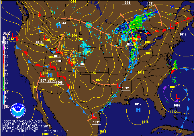
Wednesday – a complex weather situation develops as a coastal low that forms offshore of the Georgia/Florida border Tuesday makes its way up the Northeast coast. Temperature profiles seem to be pointing towards a mostly snow event (the first big snow storm for the region). With the cold front pushing through late Tuesday, temperatures Wednesday will likely peak in the morning around 40 and start to drop slowly through the day as precipitation moves in across the area, generally from southwest to northeast. Wind will start to pick up, first from the southeast, then east and gradually becoming northeast between 25-35mph.nam-hires_namer_048_1000_850_thick

The tricky part about this forecast is that there is still enough uncertainty in the storm track for there to be some last minute changes. As it currently stands, the center of the strengthening coast low is forecast to move on top of or just west of the 40ºN 70ºW benchmark, a scenario that favors a high-impact nor’easter type event for our region. Winter storm watches are already up over much of the interior Northeast. In these areas, we are looking at anywhere from 4-10″+ (depending on where the heaviest band sets up). Along the coast, under the current forecast track and methodology, it is looking like enough rain mixes in during the day Wednesday to keep snow accumulations from topping 5-6″.

Again the storm track could change, and if the track moves slightly to the east, the heavier snow could hit the city, along with some colder air. Regardless, this does not bode well for people who are doing last-minute traveling for Thanksgiving. I would expect widespread flight delays, while traffic conditions on the road could deteriorate quickly especially later in the day with temperatures dropping and snow beginning to stick.

Thursday – Thanksgiving Day itself looks like it will be OK for the parade, and other activities. The coastal storm will have pulled to our northeast, and any lingering effects should clear up early. Temperatures will be around the 40 degree mark in the city, which means that snow which accumulates will not melt all that quickly.

Friday – will be the coldest day of the holiday stretch, with temperatures only in the mid-30s. Areas of snow that have melted during Thursday could re-freeze.

The remainder of the holiday weekend looks good so far, with no major precipitation anticipated until Sunday/Monday.


NYC Weekend Weather – Nov 20, 2014

We got a break from the arctic chill briefly today, but temperatures will fall again for Friday as a cold front currently sitting on top of us passes through. High pressure builds in Friday allowing for sunny conditions, but temperatures will still not be that warm. A big warm up is in store for the second half of the weekend and we could be hitting a rainy low-mid 60s by Monday.

Friday – following the passage of a cold front sitting over us now, skies will clear up overnight tonight and allow for excellent radiational cooling, so low temperatures will be generally in the upper 20s in the city. High pressure works its way in Friday, but with the influence of a cool west wind, the high temperature will probably still only be near 40.

Saturday – another nice day, with plenty of sun, and temperatures will be slightly warmer in the mid-40s, but the big warm up won’t occur until Sunday.

Sunday – a low pressure center with its origins over the Texas Panhandle will be moving northeast towards our area. A warm front will rotate around in front of it, allowing for the influx of a comparatively very warm and moist airmass into the area. The chance of rain will increase steadily along with cloud cover throughout the day Sunday such that by the late evening, showers will be likely. High temperatures should be in the mid-50s.

gfs_namer_081_1000_850_thick
Significant warm up ahead for the latter half of the weekend going into early next week

Monday – as the forecast map from the Weather Prediction Center below shows, the low pressure system from the map above is forecast to intensify significantly as it pulls northeast. This is a classic, mature mid-latitude cyclone with an occluded low and front (purple line extending from the center of the low), a cold front, and a warm front. The warm front will rotate through first, allowing us to get into the warm sector, where there will be plenty of energy and moisture for rain, which could occur in periods throughout Monday. High temperatures will be balmy in the mid-60s.9khwbg_conus

Thanksgiving Storm?

The chance of a significant Thanksgiving storm is decreasing, though not completely nil. Once the cold front above passes, we’ll see a return to cooler temperatures in the low 50s. It’s worth mentioning that the set up behind the cold should once again favor lake effect snow, so if you’re traveling to any of the usual snow belt areas around the Great Lakes, be prepared.

Stunning Satellite Images – Lake Effect Snow

In my previous post, I discussed the ongoing epic and record breaking lake effect snowstorm that’s absolutely pummeled areas of the Great Lakes snowbelts, with the Tug Hill Plateau area south of Buffalo the worst affected. Snowfall totals yesterday were already approaching 6 feet, and this morning, the snow continues to pile up. Check out this series of satellite images and accompanying analysis. These images are simply stunning in how clearly they demonstrate the powerful effects of lake effect snow.

GOES15152014324lZHDhP
Satellite image of the Great Lakes captured by Geostationary Operational Environmental Satellite. You can clearly see bands of lake effect snow streaming across the entire region.

goesedit

Screen Shot 2014-11-20 at 10.46.47 AM
Weather Prediction Center’s analysis of current surface conditions – note the low pressure center over extreme NE Ontario/SW Quebec

A close up of Lakes Erie and Ontario – luckily for these folks, winds will finally begin shifting tomorrow as that low pulls away and winds shift from ideal direction for long fetches across the lakes to the northwest.

GOES15152014324W9zgLU goesedit2

Epic Lake Effect Storm

As you know, I try to stick to local weather, but from time to time, a weather event occurs that you just can’t help talking about. Over the course of the last two days, areas in the snow belts around the Great Lakes have been pummeled by an epic lake effect snow event. The snow belt in the Tug Hill Plateau south of Buffalo has seen the worst of it, with snowfall totals in certain neighborhoods already approaching six feet. And it isn’t over yet!

instagram_direct-wilfuen-857229331053732246_16330055
From Wil Fuentes on Instagram (@wilfuen) – sourced from Time.com

Based on observations from the National Weather Service data, it looks like wide swathes of the area south of Buffalo just got hammered with snowfall ranging anywhere from 36″-60″ (3-5 feet!) of snow.

Screen Shot 2014-11-19 at 6.58.17 PM
Measurements of snowfall around Buffalo – check out that 57″ number south of Elma, NY
ruc_snow_precip_24hr_2014111905_Southern_Great_Lakes
National Snow Analysis from National Weather Service – 35″+ observed in a period of 24 hours!

The snow is so brutal that the Buffalo Bills are scrambling to clear Ralph Wilson Stadium ahead of a scheduled game on Sunday. Lake Effect Snow Warnings are still in force in the area – and there are forecasts of an additional two feet of snow in the next couple days. The NFL may need to move or postpone the game if the Bills can’t get the snow cleared in time. The team is giving away tickets and such to anyone who’ll help dig out.

What is Lake Effect Snow?

Lake effect snow occurs when very cold air flows over a relatively warm body of water. As the cold air blows across the surface of this warmer body of water, it can quickly become saturated with moisture that evaporates (cold air can become saturated quickly because it inherently cannot hold that much water vapor). When this now saturated airmass hits the opposing shoreline, orographic (terrain) forcing causes the air to rise up (leading the airmass to become so cold that the moisture is forced to precipitate out), and provides the energy to spark of often intense, highly localized precipitation events.

This particular event has been so prodigious partially because of the alignment of winds over the surface of Lake Erie. Fetch, or the distance over which air flows across a body of water, greatly influences the severity of a lake effect storm. The longer the fetch, the more time the air has to pick up moisture off the water. In this case, the water temperature of Lake Erie is still relatively warm since air temperatures have not been that cold yet, and the winds are oriented such that the fetch is maximized over the surface of the lake (from west-southwest to east-northeast). Conditions should improve rapidly by Friday as high pressure over the Central Plains moves to the east and winds shift to the northwest.

Screen Shot 2014-11-19 at 7.30.44 PM

NYC Weather Update – Nov 17, 2014

The main headline for weather this week will be bitterly cold temperatures that are highly abnormal (in fact, possibly record setting) for this time of the year. We’re talking lows on Wednesday morning in the low 20s in the city, teens and even single digits north and west, and wind chill values in the single digits with a stiff west wind. The cold air finally breaks this weekend, though, with the arrival of a storm system that will push warm air in from the southwest.

Tuesday – high temperatures tomorrow will only be in the mid-30s under sunny skies following the passage of a cold front that’s currently right at our doorstep. Behind this front, breezy west winds between 20-25mph will pick up with wind gusts as high as 35mph. That will translate to wind chill values in the 20s for most of the day tomorrow.

Wednesday – we could break some records for lowest maximum and minimum temperatures Wednesday. Lows overnight Tuesday into Wednesday morning may only be in the low 20s, and with a west wind still kicking around 20mph, wind chill values will be in the low teens by daybreak. Temperatures won’t rebound much during the day either, with a high temperature forecast to be barely at the freezing mark.

gfs_namer_069_1000_850_thick

Thursday – temperatures should rebound considerably with the passage of a warm front late Wednesday and prior to another cold front passing later Thursday. High temperatures should reach the mid-40s. This front will be moisture-starved, so we’re not anticipating any precipitation.

Friday – temperatures will slide back into the upper 30s and low 40s after the cold front.

Warmup this Weekend

We finally snap this bitter cold spell with an influx of warm air from the Gulf streaming ahead of a storm system that will move in next Monday. This weekend should feature gradually warming temperatures, and by next Monday we could hit 60 briefly.

gfs_namer_153_1000_850_thick


NYC Weekend Weather – Nov 14, 2014

You can feel the chill in the air now. This cold will continue Saturday, but we’ll get a slight warmup Sunday and Monday ahead of a low pressure system moving in from the southwest. Behind that low pressure system, we get a reinforcing blast of arctic air that will be entrenched through the rest of next week. I’m also monitoring the potential for a Nor’easter just in time for the busy travel day Wednesday and through Thanksgiving.

Saturday – a cold day on tap despite ample sunshine. High temperatures will be generally in the lower 40s. There’ll be a noticeable northwest wind making it feel like it’s in the 30s.

Sunday – a milder day with warm air flowing in ahead of a low pressure system, but by warm, I mean highs only around 50. Clouds will increase throughout the day and there could be some rain Sunday night.

Monday – rain will be falling for the majority of the day, with highs in the city in the mid-40s. Monday night gets interesting with the potential for a rain/snow mix in the city, and all snow in interior regions north and west. Depending on the timing of the main slug of precipitation with this system, we could actually get some accumulating snow in the city also (the later in the night the main body of precipitation falls, the colder it will be, and the better the conditions for snow).gfs_namer_075_1000_850_thickTuesday – cold air rushes back in behind this storm on Monday and we drop back into high temperatures hovering in the low 40s.

Potential Thanksgiving Nor’easter?

In looking ahead at the long-term GFS model output, I’m noting the possibility for a possible high-impact Nor’easter that would be timed to coincide with the busiest travel day right before and then during Thanksgiving. Of course, this far out, there’s still considerable uncertainty to the forecast, so this scenario could not pan out, or the storm track could be nowhere close to where it needs to be to produce a high-impact Nor’easter. Still, it’s worth watching, as it could be a major headache for folks if it does materialize.gfs_namer_276_1000_850_thick (1)

NYC Weather Update – Nov 11, 2014

I hope you all took advantage of this gift of incredibly warm weather that coincided with a federal holiday, because that’s going the be the last gasp of mild weather for at least the next 7-10 days. As you probably heard, we are going to get walloped by an arctic airmass the latter half of the week that will bring an abrupt end to fall temperatures and make it feel like we jumped straight into winter – I’m talking high temperatures that won’t even get out of the low 40s by week’s end. Before you ask, no this is not a polar vortex – it will be damn cold nonetheless.

Wednesday – this will be the last day we get above 60 degrees for quite a while. We are currently in a warm sector in between a warm front that pushed through earlier this week and ahead of a cold front that will be open the door to an arctic airmass swinging down from Canada. High temperatures in the Central Plains and Intermountain West where this airmass has already taken hold are ranging from the teens to the 30s. But Wednesday, we’ll still be in the mid-60s, although it won’t be as pleasant as today with a foggy and cloudy start to the day. Once the cold front below passes, clouds should clear quickly and lead to excellent conditions for radiational cooling, with low temperatures dropping into the low 40s and into the 30s in the interior areas north and west.Screen Shot 2014-11-11 at 5.49.52 PM
Thursday – it won’t be that cold just yet, with high temperatures still expected to hit the low 50s. But clouds will again increase ahead of a second, quick-moving storm system that is expected to pass through Thursday night into Friday. This will be the real arctic sledgehammer that brings seriously cold air into the region. There will be enough energy and moisture in the atmosphere for the possibility of rain/snow mix on Thursday night and even all snow in the city Friday morning.

Friday – skies should clear quickly during the day Friday, but despite all the sun, temperatures will struggle to hit the mid-40s. Arctic air will be firmly entrenched from this point on until as long as Thanksgiving!

Saturday – High pressure will be in control Saturday, high temperatures will have a difficult time hitting 40 though, because the setup of the high will favor northerly winds. gfs_namer_096_1000_850_thickSunday – yet another storm system brings us the chance for some precipitation. Behind that system – you guessed it, more cold air and temperatures that will be two standard deviations below normal for this time of year, as per our local forecast office.

For those of you who are interested in the long-term outlook, based on forecast models and the arctic oscillation index forecast, it looks like this blast of cold air will be sticking around with us for at least the next 7-10 days, and may not break until Thanksgiving. The Arctic Oscillation measures the climate pattern of winds circulating at high latitudes close to the arctic. When it is in it’s negative phase (as is about to be the case, on the right end of all the charts below), higher pressure tends to dominate over the arctic while lower than normal pressure occurs in mid-latitudes (i.e. our area). Air tends to flow from areas of high pressure towards areas of low pressure, so this pattern sets up favorable conditions for the intrusion of bitterly cold air into our region.

ao.sprd2

NYC Weekend Weather – Nov 7, 2014

A gloomy looking Friday will give way to a sunny though cool weekend. Next week starts off with near normal temperatures and dry conditions, but get ready for a blast of Arctic air later in the week with high temperatures falling into the mid-40s by the end of next week.

Saturday – cool but sunny to start. High temperatures will be in the low 50s. Clouds build in advance of a passing cold front Saturday night into Sunday morning.

Sunday – a moisture starved cold front will approach from the west, and precipitation is not expected in NYC, though could see some spotty showers in interior regions. High temperatures will be slightly warmer in the mid-50s.noaad3

Monday – high temperatures again in the mid-50s with partly cloudy skies.

Tuesday – another good day weather-wise with highs in the mid-upper 50s and mostly sunny skies.

We will feel the effects of a strong cold front next Wednesday. A Canadian Arctic airmass will work its way into the region following this frontal passage, leading temperatures to plummet down into the 40s!

NYC Weather Update – Nov 4, 2014

Election Day features temperatures much above normal for this time of year, with high temperatures in the mid-60s under mostly sunny skies. Wednesday continues the warm trend but with increasing clouds. We’ll see another stormy end to the week before conditions improve this weekend.

Tuesday – the remainder of the day will feature high temperatures in the mid-60s reminiscent of early October and not November. This is all thanks to a warm front that passed through (you can see this in the diagram below for Wednesday, up and to the right of NYC demarcated by the red line). Go out and enjoy this while you can, and don’t forget to vote!

Wednesday – we’ll see an even warmer day despite the increase in cloud cover ahead of an approaching cold front. Southwesterly flow will allow warm, tropical air to surge into the area from the Gulf. This plume of warmth and moisture will also prime the atmosphere ahead of Thursday’s storm. The cold front itself will weaken as it passes, so we’re not anticipating any rainfall. High temperatures will be generally in the upper 60s.noaad2

Thursday – a storm system with its origins in the Great Lakes/Ohio Valley area will form a secondary low near the offshore waters of the Northeast. Despite being only 2 days out, there’s still some uncertainty to the ultimate track of this storm system. The general pattern will be somewhat similar to last week, with the coastal storm forming and then slowly making its way northeast. The availability of deep moisture suggests the possibility of bouts of heavy rain during the day Thursday into Thursday night. When all is said and done, we could be looking at rainfall totals in the 1.5″-2″ range across the area, depending on the final track of the storm. The further west the track, the further west the highest impact areas will be, and the inverse for tracks further east. High temperatures will remain mild until after the storm departs to the northeast, with high temperatures in the low 60s.

gfs_namer_072_1000_850_thick
GFS model output for Thursday

fill_99qwbg


Friday – rain should end early Friday as the low lifts to the northeast. Winds will pick up and shift towards the north, resulting in much cooler high temperatures only in the mid-50s.

We get a  cool but sunny Saturday before another chance of rain Sunday.