After a brief deep freeze, we’ll see a significant change in the weather with a complex storm system that will affect the area to start the week, bringing a mix of precipitation along with much warmer temperatures. Things quiet down by mid-week, and temperatures moderate towards more normal levels.
Rest of today – cloudy with temperatures rising into the low-mid 30s. Flurries have already begun falling in some parts of the city. Snow will become more steady and increase in coverage during the course of the afternoon. For those of you who do not have the day off, it’s shaping up to be a messy commute with snow transitioning to a wintry mix, with periods of freezing rain during the evening commute. Prior to the transition from snow, areas along the coast could pick up 1-2″ of snow, with higher totals in the interior north and west.

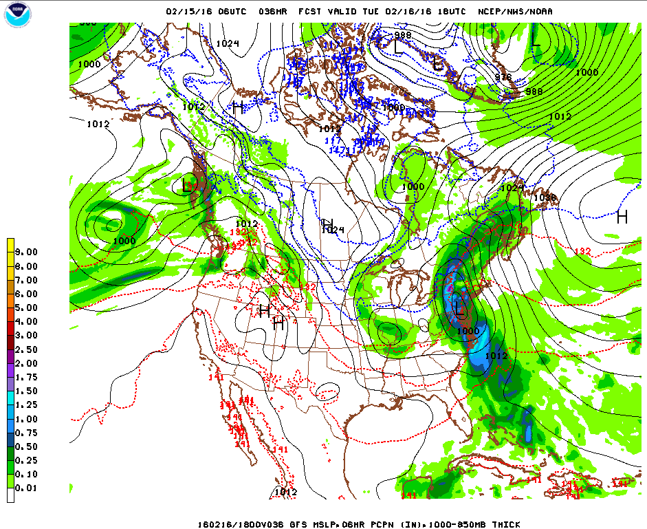
Tuesday – after a brief dip in temperatures early on during the overnight hours, temperatures will actually start increasing as a warm front passes through. Since the ground itself is still quite cold due to the deep freeze this past weekend, freezing rain and wintry mix will still be lingering around until temperatures start to climb well into the mid-upper 30s. At that point, we’ll transition over to all rain, and periods of moderate to heavy rain will likely affect the area Tuesday afternoon into the evening hours as a cold front pushes through. Temperatures will be very warm Tuesday, with highs topping out in the mid-50s – 15-20ºF above normal for this time of year.

Wednesday – high pressure starts to build back in after the storm system moves out Tuesday. Temperatures cool off back into the mid-40s, with clearing skies.
Thursday – cooler, with high temperature around 40ºF and sunny skies.