Monthly Archives: July 2016

NYC Weekend Weather – Jul 28, 2016

We finally get a break from the heat along with some much needed rain in the next few days. Saturday looks to be the best day of the weekend. High temperatures this weekend will range anywhere between 15-20ºF cooler than last weekend. 

Overnight – lows in the mid-70s as a low pressure center passes almost directly over NYC. Because the low will be right over us, the main area of the heaviest rain will remain north of the city.

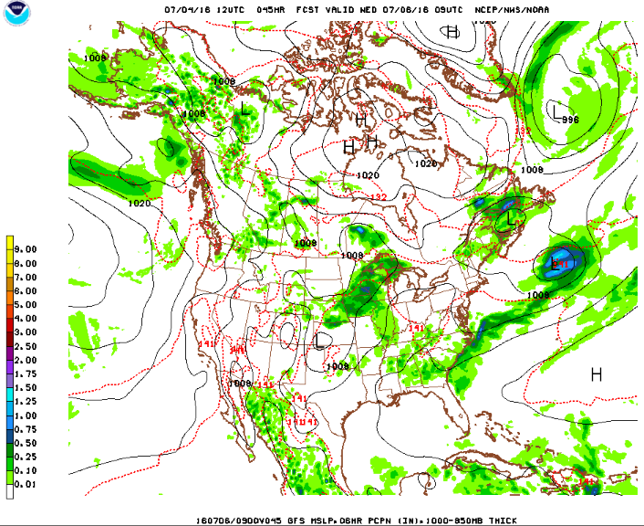
Friday – showers punctuated by periods of steady, heavier rain as bands of rain develop and wrap around the low pressure center as it tracks east. High temperatures in the low-80s with overcast skies. This low pressure system will thrive off the humid, tropical airmass in place over the region. A flash flood watch has been issued to reflect the possibility of some areas receiving 1-2″/hour rains. Embedded thunderstorms are possible, but are unlikely to reach severe limits. The bulk of the rain will fall overnight into the morning hours, and should begin tapering off in the afternoon from west to east. 

Screen Shot 2016-07-28 at 6.53.30 PM fill_94qwbgSaturday – high pressure passes briefly giving us a mostly dry day with partly sunny skies with highs in the mid-80s.

Sunday – another disturbance pushes through from the south providing more chances for rain and thunderstormsMostly cloudy with highs in the low-80s otherwise.

Screen Shot 2016-07-28 at 6.55.33 PM

Monday – skies gradually clear and temperatures warm back into the low-mid 80s.

Tuesday – warm and sunny with highs again in the mid-80s

Drought Conditions Forecast to Persist

Despite the rains this weekend, many parts of the area remain under a moderate drought, having received only about 25% of normal precipitation for this past month. The outlook for the season calls for persistence of drought conditions as below normal to normal precipitation will be insufficient to break the drought.

season_drought

NYC Weather Update – Jul 25, 2016

Recent weather headlines have been dominated by the heat. This will continue through most of the week, with relief not really in sight until Friday. There will be a chance for severe thunderstorms today, but otherwise, there will be little in the way of rain.

Rest of today – mostly sunny, hot, with highs in the mid-90s. Humidity will make it feel like the lower-100s. The Storm Prediction Center has placed parts of the region under a slight risk for severe weather today. This relates to what appear to be multiple line segments of strong to severe thunderstorms advancing ahead of a weak cold front that look to impact the area during the PM rush.

Screen Shot 2016-07-25 at 10.47.24 AM

Tuesday – with the weak cold front above passing through, there will be some drop in humidity. However, temperatures are still expected to rise into the mid-90s under mostly sunny skies.

Wednesday – temperatures finally start to back off the mid-90s into the low-90s under mostly sunny skies.

Thursday – increasing clouds, high near 90ºF.

Drought Continues to Grip the Northeast

Drought continues to worsen and is now prevalent in many parts of the Northeast, with areas in Western New York and Massachusetts particularly hard hit.

20160719_northeast_trd

NYC Weekend Weather – Jul 21, 2016

This weekend’s weather can be summed up in one word: hot. In fact, if current forecasts hold, this upcoming stretch may see our first extended 90ºF+ heat wave. High temperatures don’t appear likely to drop below 90ºF until next Wednesday. During that time, the humidity will actually increase until a cold front breaks through late Tuesday. This will be another prime beach/upstate getaway weekend.

Rest of today – sunny with a high around 90ºF.

Friday – mostly sunny, slightly warmer with a high in the low-90s. There is a chance for strong to marginally severe thunderstorms late Friday with the passage of a cold front. Any relief from heat that this front and storms associated with it bring will be short-lived.

Saturday – high pressure quickly returns and temperatures continue to rise along with it. Highs are expected in the mid-90s with mostly sunny skies.

Screen Shot 2016-07-21 at 9.28.34 AM

Sunday – a bit cooler, but humidity will increase as a warm front pushes through late on Sunday. High temperatures in the low-90s.

Monday – showers and thunderstorms are possible later Monday preceding a cold front that is forecast to pass on Tuesday. Highs will remain in the low-90s.

Above Average Temperatures to Stick Around

The Climate Prediction Center’s 6-10 Day and 8-14 Day temperature outlook continues to call for above normal temperatures. The heat is here to stay.

610temp.new814temp.new

NYC Weather Update – Jul 18, 2016

This week will be bookended by hot weather, with a break from the heat forecast right in the middle. The only chance for rain during this stretch will be later this afternoon and into the early evening hours.

Rest of today – the Storm Prediction Center has placed parts of the region under a slight risk of severe weather today as a cold front approaches. As usual, areas north and west of the city are more likely to experience organized convective activity, since there will be a stabilizing influence near the coast from the marine air layer. Best timing would appear to be in the evening rush, when a couple lines of thunderstorms could affect the area. High temperatures will reach into the low-mid 90s before this under mostly sunny skies.

day1otlk_1300 Screen Shot 2016-07-18 at 10.06.13 AM

Tuesday – with the passage of the the cold front above, there will be a noticeable change in the humidity level for Tuesday. Despite high temperatures reaching into the upper-80s, it will feel considerably more comfortable with the drier air in place.

Wednesday – an area of high pressure behind the cold front will take over for the latter portion of the week. On Wednesday, it will be set up just to our southwest, which will enable cooler winds from the north to bring a brief respite from the heat. High temperatures are only expected to reach into the low-mid 80s.

Screen Shot 2016-07-18 at 10.08.24 AM

Thursday – as the high pressure moves off to the east, winds will turn to the west and southwest, and there will be a corresponding increase in high temperatures into the mid-upper 80s again as warmer air returns.

NYC Weekend Weather – Jul 14, 2016

It will be a steamy, hot end to the week before the temperatures cool down a little and we get to enjoy a weekend of idyllic summer weather. Some potential for severe thunderstorms exists Thursday. A scattered thunderstorm chance also exists Friday and Saturday night, but the days look dry.

Rest of today – mostly cloudy, hot, humid, with high temperatures in the upper-80s to near 90ºF. A strong to severe thunderstorm is possible this afternoon, particularly in areas north of the city. If we do get clipped by storms in the city, we’ll be on the very southern periphery of the stronger storms, so it doesn’t seem all that likely we’ll see severe weather. Best timing for storms will be in the 3-6PM range.

Screen Shot 2016-07-14 at 10.37.57 AM

Friday – with more sun, Friday is expected to be even hotter than today with highs in the low-mid 90s.

Saturday – even though a cold front will finally pass through Friday, the frontal passage will not bring relief from the heat Friday (the frontal boundary separates two airmasses of disparate dewpoints, and not temperatures). Temperatures will hold in the upper-80s to 90ºF Saturday with mostly sunny skies. It will be an ideal day for heading to the beach as there should be a sea breeze on south-facing shores resulting in 5ºF cooler temperatures.

Sunday – warm, with high temperatures in the mid-upper 80s and partly sunny skies.

NYC Weather Update – Jul 12, 2016

This week started off with refreshing weather Monday. Temperatures will rise slowly during the course of the week with Friday being the hottest day. The only precipitation chance appears to come on Thursday when a cold front approaches the region.

Rest of today – mostly sunny, seasonably warm, with a high in the low-mid 80s.

Wednesday – temperatures begin slowly warming up as high pressure which has been sitting right over us moves to our east. This will allow a warmer southwesterly flow of air into the region.

asdf

Thursday –  warmer still, possibly with high temperatures hitting 90ºF in some spots. In general, high temperatures will reach into the upper-80s. A chance for showers and thunderstorms will build in the afternoon along with the heat and the approach of a cold front.

Friday – partly cloudy, hot with a high near 90ºF.

Drought Expands Despite Rain

With a dearth of rain continuing, some areas of the northeast (much of Eastern Massachusetts) have been placed under an area of severe drought. For us, a moderate drought persists, despite the fact that we’ve had several rounds of drenching rain over the last couple weeks.

20160705_northeast_trd

NYC Weekend Weather – Jul 7, 2016

The end of this week will likely see the first official heat wave of the year, typically defined as 3 or more days with 90ºF+ temperatures. The hot and humid weather comes to a close this weekend as a backdoor cold front brings relief by Sunday. A couple rounds of active weather could crop up this afternoon and again Friday night.

Rest of today – hot, humid, with a high in the low-90s. Periods of clouds and sun with increasing clouds this afternoon. The area is under a flash flood watch due to the impending onset of showers and thunderstorms capable of generating heavy downpours of 1-2″/hour. You can see from the satellite image below that discrete, pulse type storms are already building. Coverage of these storms will increase and they will encounter conditions conducive for strengthening, with plenty of moisture in the atmosphere, no capping to speak of, and lots of sunshine leading to MLCAPE values between 1000-1500 J/Kg. Storms should die down by later this evening. If you’re out and about, carry an umbrella because you may get dumped on.

GOES16252016189O6RcVE

Friday – any relief from the heat from the storms today will unfortunately be short-lived. Temperatures Friday are expected to rise into the low-90s once again under mostly sunny skies. Friday night, as a backdoor cold front the northeast (so-called because it moves from northeast to southwest, the opposite of most cold fronts in the mid-latitudes of the Northern Hemisphere), we could see another round of showers and thunderstorms capable of producing heavy rain across the area.

98fndfd

Saturday – with the backdoor cold front slowly progressing through the area during the day, some potential exists for scattered thunderstorms. Temperatures will be more comfortable in the mid-80s with mostly sunny skies otherwise.

Sunday – mostly sunny with a high in the mid-80s. Best day of the weekend!

NYC Weather Update – Jul 4, 2016

Rain moves through tonight, and then temperatures warm through the course of the week as a Bermuda high takes control. There’s a chance for showers and thunderstorms Thursday – otherwise this week will certainly feel like summer.

Rest of today (Independence Day) – increasingly cloudy, with a high near 85ºF. Forecasts last week seemed to indicate a rain-free weekend outside of Friday night when we experienced some severe thunderstorms. It now appears that an area of low pressure tracking to our south will bring rain to the area tonight. Currently, the timing of the rain appears to bring it in the city right around the time that the fireworks display is scheduled to kick off. The heaviest rain won’t begin falling until later tonight, so I don’t think this will wash the fireworks out, but it will result in less than ideal viewing conditions if you plan on being outside at the display.

Screen Shot 2016-07-04 at 1.56.57 PM

Tuesday – steady rains should end by the morning rush tomorrow, though a lingering shower could pop up till around noon. Decreasing clouds with high temperatures in the mid-80s.

Wednesday – temperatures heat up into the low-90s, with dewpoints holding steady in the mid-upper 60s, it will feel like August. A Bermuda high will take hold through the end of the week, which could bring our first heat wave of the season.

Screen Shot 2016-07-04 at 1.50.08 PM

Thursday – mostly sunny with a chance of thunderstorms developing late in the day. High temperatures around 90ºF.