This week starts off with a heat wave, with high temperatures expected to top 90°F up through Wednesday. A chance or showers and thunderstorms Wednesday will not bring too much in the way of relief from the heat and humidity. The air mass behind the cold front moving in Wednesday is only slightly cooler and less humid than the one in place now.
Rest of today – hot, humid, with high temperatures in the low-mid 90s.
Tuesday – more of the same, hot, humid weather with highs in the low-90s. A chance exists for some scattered showers and thunderstorms late in the day.
Wednesday – more organized showers and thunderstorms are expected to pass though late in the day Wednesday and overnight into Thursday as a cold front approaches from the west. High temperatures ahead of the front are expected to be in the low-90s again.
Thursday – a chance for leftover a shower or thunderstorm exists early, then improving conditions with high temperatures in the upper-80s and mostly sunny skies.
Friday – looking sunny now, with highs in the upper-80s.
This weekend kicks off a stretch of cooler, drier, true-to-form autumn weather after last week’s decidedly summer-like days. A low pressure center over the Great Lakes will slide southeast towards the region to start the weekend. This could scattered showers and thunderstorms. Aside from that, conditions will be dry and fair for the remainder of the forecast period.
Rest of today – high temperatures right about 70°F with sunny skies, much drier feel to the day.
Saturday – scattered showers and thunderstorms possible, especially early. High temperatures in the upper-60s, cooler in spots that see rain.
Sunday – sunny, high temperatures again around 70°F. High pressure from Canada behind the low pressure above will keep things dry and cool for much of the next week.
Monday – slightly warmer, high temperatures in the low-70s, again mostly sunny.
We enter a week of weather that will very much feel like summer, with temperatures warming up during the midweek period. Each day, there could be a chance for showers or thunderstorms, though these will be more of the scattered variety. Temperatures return to more seasonable levels by the weekend.
Rest of today – partly cloudy with scattered showers and thunderstorms popping up this afternoon in some spots. A few storms could become strong or even severe. Temperatures in the mid-80s.
Tuesday – another chance for showers and thunderstorms in the afternoon with a weak front in the area, but partly cloudy otherwise and temperatures again in the mid-80s.
Wednesday – warming up with temperatures edging closer to 90°F. Partly cloudy skies, with a chance for showers and thunderstorms again especially during the late afternoon and evening hours.
Thursday – hottest day of the week with temperatures in the low-90s. Partly sunny, and there is a chance for showers and thunderstorms as a cold front passes through the area, but the timing of this frontal passage is as yet not completely certain. Current thinking is that the front passes through overnight into Friday.
Friday – still quite warm in spite of the cold front passing through, high temperatures around 90°F again and mostly sunny.
What a difference a week makes. Since Wednesday, we’ve seen temperatures slide from record heat in some places. An unsettled weather pattern takes hold through the weekend and into next week with chances for showers and thunderstorms each day.
Rest of today – Cloudy, temperatures on the cool side with high temperatures only in the low-70s. Multiple chances for mainly showery precipitation with a warm front slowly creeping towards us. Two primary batches of rain look to affect the area around noon then again in the late evening around 10pm.
Saturday – the warm front mentioned above should push through, but could be slow to do so which would result in a lower high temperature like today as opposed to the upper-70s. Both before and after the warm front passage there’s a chance for scattered showers and isolated thunderstorms. Generally mostly cloudy.
Sunday – we’ll be in the warm sector between the exiting warm front and an approaching cold front. High temperatures will respond by climbing into the mid-80s. Could start the day off with scattered showers. The majority of the day looks rain-free though cloudy. Not a total washout for Father’s Day, but not ideal either.
Monday – the cold front pushes through late in the day. High temperatures again in the low-mid 80s. There’s some possibility for strong to severe thunderstorms with associated with this cold front. Plenty of moisture in the atmosphere would easily yield some heavy downpours as well.
Rain moves through tonight, and then temperatures warm through the course of the week as a Bermuda high takes control. There’s a chance for showers and thunderstorms Thursday – otherwise this week will certainly feel like summer.
Rest of today (Independence Day) – increasingly cloudy, with a high near 85ºF. Forecasts last week seemed to indicate a rain-free weekend outside of Friday night when we experienced some severe thunderstorms. It now appears that an area of low pressure tracking to our south will bring rain to the area tonight. Currently, the timing of the rain appears to bring it in the city right around the time that the fireworks display is scheduled to kick off. The heaviest rain won’t begin falling until later tonight, so I don’t think this will wash the fireworks out, but it will result in less than ideal viewing conditions if you plan on being outside at the display.
Tuesday – steady rains should end by the morning rush tomorrow, though a lingering shower could pop up till around noon. Decreasing clouds with high temperatures in the mid-80s.
Wednesday – temperatures heat up into the low-90s, with dewpoints holding steady in the mid-upper 60s, it will feel like August. A Bermuda high will take hold through the end of the week, which could bring our first heat wave of the season.
Thursday – mostly sunny with a chance of thunderstorms developing late in the day. High temperatures around 90ºF.
After a rainy day today, the rest of the week and looking ahead into the weekend will feature pleasant and mostly sunny weather with temperatures above normal for this time of the year. The weather should cooperate with outdoor plans for this Memorial Day.
Rest of today – mild, but cloudy, with periods of rain this afternoon associated with a low over Cape Cod until around 5PM. High temperatures around 70ºF.
More showers this afternoon
Wednesday – high pressure will build to the southeast as the low pressure system departs to the northeast. Much warmer temperatures in the mid-80s will be on top tomorrow with plenty of sun.
Thursday – a few degrees cooler than Wednesday but still quite nice with high temperatures in the low-80s and mostly sunny again.
Friday – a couple degrees cooler with a high in the upper-70s to around 80ºF, yet another splendid day.
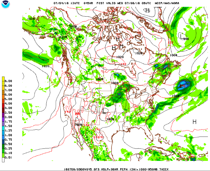
This short holiday week will feature decent weather for the most part, with the exception of Tuesday night into Wednesday morning. As of now, it does appear that there will be a chance of showers/thunderstorms on July 4th itself, however, uncertainty and considerable disparities between different forecast models has been noted by forecasters. We should have a clearer picture of the situation later this week.
Rest of today – clouds gradually increase in coverage during the day today with high temperatures in the low-80s. Overnight, chances for rain will steadily pick up as a warm front approaches the area from the south and west.
Wednesday – a mostly cloudy day with highs in the low-mid 80s. There is a good chance for showers early on in the day. However, the chance of rain starts to diminish in the afternoon, and it is unclear if there will be enough instability remaining in the atmosphere following the passage of the warm front above to support more rain or storms.
Thursday – a cold front following on the heels of the warm front mentioned above will mean that there is still a chance for showers and thunderstorms as that frontal boundary approaches. Temperatures should be similar to Wednesday, in the low-mid 80s.
Looking ahead at the holiday weekend, it looks like both Friday and Sunday should be mostly sunny with temperatures in the low-80s. There is a small chance for rain and thunderstorms for Independence Day, but there is enough forecast uncertainty in the forecast models to hope for a dry day Saturday as well.
The atmosphere over the area the past couple days has been both exceptionally dry and abnormally cool. This trend will end Friday with the approach of a cold front and low pressure system. Because the air mass currently in place is so dry, it will be difficult for the air to moisten at the outset Friday. Thus, forecasters are calling for a mostly dry day with increasing cloud cover, and rain showers moving in over the course of evening and overnight hours. High temperatures Friday will remain in the low 60s.
North American Model simulated radar image for Saturday @ 2PM EST
Saturday will remain a cloudy day with the chance for showers diminishing but still present. As the simulated radar image above suggests, there should be a break in precipitation between Friday evening and Saturday afternoon. However, it does appear that there is enough upper air support for afternoon showers and even some scattered thundershowers are possible Saturday afternoon. High temperatures will be warmer in the upper 60s. Skies should gradually clear once showers pass through, so the latter half of the day will still be sunny.
Sunday temperatures will cool off again with the passage of the cold front Saturday, however, sunny skies will return with high pressure building. Temperatures should be pleasant in the low 60s. Monday looks at this point to be a clone of Sunday.
Severe Weather in the Great Plains Sunday
It’s definitely severe weather season at this point in the Plains States and Tornado Alley. These areas have been repeatedly pummeled the past few days by severe hail storms. This weekend promises to be no different. As you can see below, a strong low pressure center is forecast to develop in the lee side of the Rockies Sunday with central pressure as low as 988mb.
Meanwhile, in the upper atmosphere, a vorticity maximum (see below) is forecast to form, with an area of strong divergence just to its east near the forecast center of the surface low. Upper level winds will be largely unidirectional. These are all ideal conditions for a severe weather outbreak. As a result, a wide swath of the Plains States from central Texas through Oklahoma, Kansas, and into Southeastern Nebraska have been placed under a Slight Risk area for severe weather by the Storm Prediction Center.
Note the strong low pressure center forecast to develop over the lee side of the Rockies – central pressure of 988mbUpper air charts for Sunday afternoon. Note the strong vorticity maximum (area of dark red) over eastern Colorado.


