Tag Archives: tornadoes

Southeastern PA Apr 26, 2019 Severe Weather Event Analysis

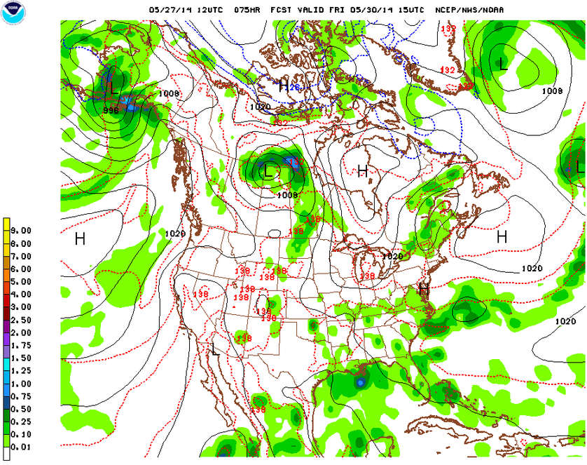
Last Thursday afternoon, April 26, 2019, a line of severe thunderstorms produced potent, damaging winds, some in excess of hurricane force that caused disruptions to regional transportation networks in the DC, Baltimore, and Philadelphia areas. These storms provide an instructive example of what ingredients are required for severe thunderstorms, and how quickly everything can come together on a given day.

Synoptic Set Up (The Big Picture)

On Thursday morning, a low centered over the Great Lakes was progressing north and east. A warm front extended south and east from this low and was moving north, with a noticeable “kink” where there was colder air at higher altitudes along the Appalachians and related foothills. South of this warm front, southerly winds were helping temperatures rise well into the upper-60s and low-70s. A cold front was located a further back and was advancing across Pennsylvania, and the Virginias. This cold front would provide the focus for lift and thunderstorms later in the day, although some more isolated thunderstorms also accompanied the warm front.

Weather Prediction Center surface analysis of this storm at 11AM on April 26, 2019

Above the surface at 850 mb, evidence suggested an axis of relatively saturated air along with a low-level jet of 35-40 knots would develop, providing the moisture necessary for precipitation. Further up in the atmosphere, a negatively tilted 500 mb trough was evident upstream of the area with the Southeast PA region also appearing to be in the exit region of a 300 mb jet streak. Both of these would help enhance lift by providing divergence aloft in the atmosphere as air was removed from the column while decelerating out of the base of the 500 mb trough and 300 mb jet streak respectively.

Fig. 1: GFS forecast model initialized at 7AM Thursday, April 26, 2019 depicting an axis/tongue of moisture (narrow area of blue) along the PA/NJ border around 5PM that day.
Fig. 2: 300 mb analysis for 8PM on Thursday, April 26, 2019. Note the densely packed yellow contours close to the Southeast PA area at this time, indicating strong net divergence in the exit region of a curved jet streak at this level (blue shaded areas with wind barbs showing max winds of 80 knots slowing to 65 knots in the exit region).

Furthermore, winds throughout the atmosphere were strong, and increasing from 35 knots at 850 mb to 60 knots at 300 mb. Meanwhile winds at the surface were light, at 5 knots or so at the from the south. Winds aloft were more from the southwest. So, there was an element of both speed and directional wind shear in the atmosphere this day.

A Sunny Afternoon and Instability

From above, we see that we had several ingredients were taking shape last Thursday: a couple frontal boundaries providing focused lift, moisture at 850 mb, vorticity and net divergence at 500 mb and 300 mb enhancing lift, with strong winds at these levels enhancing wind shear. We still needed one more key component to truly set off some strong to severe thunderstorms: instability. How does instability build up in the atmosphere? The answer has to do with the daytime heating and the sun. That’s why thunderstorms often pop up later in the afternoon when daytime heating is maximized.

Fig. 3: Storm Prediction Center mesoanalysis highlighting areas favorable for severe weather on the afternoon of April 26, 2019.
Fig. 4: Storm Prediction Center analysis of 3-hour mixed layer CAPE (convective available potential energy, a measure of instability) change. Note that the pocket of a large increase in instability corresponds to the location of the pocket of clear skies below.
Fig. 6: A marked up visible satellite image at 3:16 PM on Thursday, April 26, 2019 showing the approximate position of frontal boundaries extrapolated from the Storm Prediction Center analysis in the preceding image.

Why does daytime heating at the surface lead to destabilization of the atmosphere? This has to do with buoyancy and lapse rates. Lapse rate describes the change in temperature over a given altitude. As the sun heats the surface of the earth up, it shifts the environmental temperature line to the right on a skewT sounding as the one attached below, taken at 2PM on Thursday, April 26, 2019 at Washington Dulles International Airport (KIAD). This tends to increase instability because a warmer airmass above the surface will have greater buoyancy. A large lapse rate combined with enhanced buoyancy allows for air from the surface to rise, and keep rising forming towering cumulus clouds that can eventually build into thunderclouds. As long as a parcel rising from the surface stays warmer than the environmental temperature profile (red line), it will keep rising.

A skewT of a sounding taken at Washington Dulles International Airport (KIAD) at 2PM on Thursday, April 26, 2019. Refer to this post for how to interpret this skewT.

The Storm Prediction Center was well aware that the severe weather potential was maximized for areas that saw clearing skies in advance of the approaching cold front. They also picked up on tornado potential focused on the “kinked” warm front. This is due to the fact that such an orientation of a warm front leads to a situation where surface winds are locally backed, meaning they’re turning counterclockwise over time. This was also paired with a localized pressure fall of 3 mb over the two hours leading up to 3 PM on Thursday.

Storm Prediction Center mesoanalysis of 2 hour pressure tendencies. The area of Southeastern PA, northeast MD, and northern DE had seen a pressure fall of 3 mb leading up to 3PM Thursday.

As was the case with the Lee County Tornado that claimed 23 lives in Alabama on March 3, 2019, these locally backed winds due to the warm front and pressure falls (leading to some isallobaric winds) served to enhance storm relative helicity and create an environment favorable for storm rotation and the possibility for tornadoes. The backing winds also served to increase wind shear and the potential for severe weather. Luckily, in this case, other environmental factors weren’t supportive for a large, strong tornado.

On the March 3, 2019 EF4 Tornado in Lee County, AL

Last Sunday, while I was preparing my post on the snowstorm that was about to hit NYC and the Northeast, the southern side of this same storm system was starting to produce a serious severe weather event in portions of the Deep South. A large, violent, and ultimately deadly EF4 tornado hit parts of Lee County, AL during the afternoon. The tragic toll of 23 confirmed fatalities due to this tornado was more than double the total deaths due to tornadoes in all of 2018. This was also the deadliest single tornado since the EF5 tornado that hit Moore, OK on May 20, 2013. In this post, I’ll share some thoughts and observations about the meteorology behind this event, and about what made this tornado so powerful.

Storm Prediction Center’s Forecasts

One aspect of the event that impressed me was the prescient, geographically accurate, and timely Mesoscale Discussions and convective outlooks that the Storm Prediction Center issued during the course of the day. The SPC already had a handle on the risk for severe weather in parts of the Deep South as evidenced by the convective outlooks they issued Sunday morning.

Regarding the enhanced risk area that the SPC identified as possibly being affected by tornadoes:

The most favorable … space for tornadic potential … still appears to be within the enhanced-risk area, where strong deep shear, large low-level hodographs, and at least low-end surface-based buoyancy will juxtapose. Forecast soundings show rapid prefrontal destabilization …. [a]s that occurs, severe potential will steadily ramp up…. a few tornadoes also are possible. Tornado-event density, and risk of significant tornadoes, still is somewhat unclear — being strongly dependent on existence/number of preceding supercells that can develop…

Storm prediction center, day 1 convective outlook issued 7:52AM EDT Mar 3, 2019

SPC foresaw that the energy (instability) and spin (shear, imparted by strong winds at different levels of the atmosphere) required for strong tornadoes would have a chance to come together in the enhanced risk area. They also identified that the greatest risk would be with any supercells that could form ahead of the main line of thunderstorms that would accompany the cold front later on.

Weather Prediction Center’s surface analysis valid for 1PM EDT Mar 3, 2019, an hour or so before the EF4 tornado struck Lee County, AL

As it turned out, supercells did form ahead of the cold front – one in particular drew the attention of astute SPC forecasters, and this would end up being the supercell responsible for the tornado that hit Lee County. In follow up Mesoscale Discussions regarding the tornado watches over the enhanced risk area, SPC forecasters were remarkably accurate and timely in identifying the risks associated with this supercell and the favorable conditions it would encounter.

Lee County is circled in green in SPC’s Mesoscale Discussion #0145 surface map.

MCD #0145 was issued at 1PM CDT (local time), and contained the following text. The forecasters cited favorable conditions for a strong tornado to form within 30-60 minutes. Just around 2PM, about 60 minutes after this MCD was issued, the EF4 tornado hit Lee County.

A mature supercell located near Montgomery is favorably located within a region of maximized surface pressure falls (3-4mb per 2 hours) immediately east/southeast of the surface low. KMXX VAD shows 500 m2/s2 0-1km SRH when accounting for the observed Montgomery County supercell’s storm motion. Given the ample buoyancy and intense shear profile in place, it appears tornadogenesis will likely occur within the next 30-60 minutes with the possibility of a strong tornado occurring.

Storm prediction center Mesoscale discussion #0145, issued 1PM CDT mar 3, 2019

Why Conditions Were So Favorable for a Strong Tornado

The following analysis about the mesoscale conditions that favored strong tornadoes on this day came about from a discussion I had with Steve Corfidi, my instructor for the class I took on mesoscale forecasting (severe weather forecasting) as part of Penn State’s Undergraduate Certificate in Weather Forecasting. Steve Corfidi also used to be the Lead Forecaster at the SPC. Suffice to say, I am quite privileged to have been able to glean some insights about this storm from him. These observations are related to another MCD from SPC that day, MCD #0147.

Storm Prediction Center’s MCD #0147, issued at 2:06PM CDT, right around the time the EF4 Lee County Tornado was on the ground. Lee County is circled in green.

In this MCD, the SPC highlights an area of localized surface pressure falls in dashed blue. Steve Corfidi commented this effect is related to “rise and fall pressure “waves” that move across the earth twice-daily in response to solar heating”. As the earth heats up, air warms and rises, and this generates a thermal low since there’s less air over a warmed up spot of the earth than surrounding areas. In this case, this resulted in a localized area of surface pressure falls over the area circled in dashed blue as the day progressed. In response, surface winds will have a tendency to deflect towards the center of the lowering pressure. You can see this by looking at the wind barbs in the chart above: those that are closer to the cold front are more southwesterly, but the ones closer to the blue dashed area are actually more southerly, since they are deflecting towards the north and the localized pressure falls. This is known as the isallobaric effect. This had direct impacts on the favorability of the environment for tornadoes, as Steve Corfidi helped me understand.

My illustration of the situation over Lee County during this tornado.

As winds near the localized pressure falls became more southerly in response to isallobaric effect, this actually increased the vertical wind shear values in the area of the pressure falls (green here, blue dashed area in the SPC analysis, the red 300 mb wind profile barbs are approximated from this sounding). Since vertical wind shear is measured by looking at both the difference in direction and speed of winds at different levels, a change in wind direction at the surface, all else being equal, will result in higher wind shear. Relative to other areas in the warm sector of this storm, this produced an even higher value of storm relative helicity (SRH, as alluded to in MCD #0145) as well as the aforementioned vertical wind shear. I don’t have space to elaborate on why SRH and vertical wind shear are important for tornadoes, I will say that it has to do with enhancing storm rotation, and tornadoes are intense, vertical circulations of rotating air.

One other observation worth mentioning is that the “geometry” of the warm sector maximized the amount of time the supercell could spend in an extremely favorable environment. If you look at the large blue arrow in my illustrated diagram, check out how the approximate mean storm motion was largely parallel to the orientation of the warm front and axis of the maximized surface pressure falls. That meant that as the tornado formed, it was able to keep moving through a favorable environment for much longer than if the storm motion had been more northeasterly, or say southeasterly.

NYC Weekend Weather, a Tornado in Queens? – Aug 3, 2018

A wet start to the weekend will then give way to much warmer weather. We’ll get a break from the rain Sunday and Monday before the next shot for rain. Of note, a possible tornado may have impacted parts of northern Queens last night.

Rest of today – increasing chances for showers and thunderstorms especially in the early afternoon. Otherwise, mostly cloudy with high temperatures in the mid-80s.

Saturday – more widespread showers and thunderstorms in the morning, with some concern for flash flooding. The set up also could produce some isolated severe weather as a weak impulse of energy travels up the upper trough that’s been locked in over the Eastern US this week. Improving conditions later with highs in the mid-80s.

Sunday – the upper trough that’s been causing this week’s wet weather finally exits east. High pressure begins to build south of us, bringing warmer temperatures with highs in the low-90s and lots of sun.

Monday – more of the same as Sunday, sunny, hot and humid with highs in the low-90s.

Possible Tornado in Northern Queens Last Night

At 10:18 last night, residents in northern Queens, the eastern Bronx and northern Nassau received alerts from our local National Weather Service forecast office of a tornado warning. The damage was evident this morning, with many downed trees in College Point. A team from the NWS is assessing the damage to determine whether what hit this area last night was really a tornado, or if it was some other non-tornadic wind phenomena.

I was in a neighborhood that received this warning, but at first, I almost thought it was in error because there were no signs outside of anything awry, no thunder, no rain. However, a quick look at the base radial velocity imagery on the JFK high-definition terminal Doppler radar was revealing – there certainly was a storm with very strong rotation, hence why the warning notes “radar indicated tornado”. In the annotated base radial velocity image below, the white circle indicates a tight mesocyclonic circulation.

Without going too much into technical detail, the greens indicate inbound velocities relative to the radar station (air was flowing towards the radar), while oranges and reds indicate outbound velocities (where air was flowing away from the radar). When forecasters see a “velocity couplet” like this where inbound and outbound velocities are close together, they know this is a signature of strong storm rotation within a mesocyclone. If, within this couplet, you get a “gate to gate” (i.e. adjacent pixels) where the difference between inbound and outbound velocities exceed 90 knots, this is referred to as a “tornado vortex signature”. In this image, if you do the math, you get that the max difference between inbound and outbound velocities was 86 knots, and you an see what appears to be a tornado vortex signature.

We’ll see what the NWS’ assessment says later today, but it appears to me that there was a tornado at some point over northern Queens last night!

UPDATE (1:46PM August 3, 2018): The National Weather Service issued a report confirming that an EF0 tornado touched down in portions of College Point, Queens last night.

NYC Weekend Update – Jul 20, 2018

Last weekend’s beautiful, sunny weather will be but a fleeting memory this weekend as a coastal storm hits the area late Saturday going into Sunday. Periods of heavy rain and even some severe weather are possible Saturday night and Sunday, with the potential for isolated flash flooding. Unsettled weather continues into next week with a tropical weather pattern setting up providing daily chances for showers and thunderstorms.

Rest of today – a great start to the weekend, with high temperatures in the low-80s and sunny skies.

Saturday – cool, with high temperatures only in the upper-70s due to the influence of easterly winds ahead of a warm front attached to the advancing coastal storm. Clouds increasing late in the day and rain chances picking up in the evening hours going into overnight. Chance for heavy rain, scattered thunderstorms with gusty winds (even an isolated tornado possible). Gusty east winds will make the overnight hours feel particularly cool and miserable.

Sunday – rain chances continue into the day and even Sunday night. Temperatures increase behind the passage of the warm front mentioned above and winds shifting to the south – high temperatures should be in the mid-80s with mostly cloudy skies. All told, we could be looking at widespread rainfall totals of 1-3″ across the area.

Monday – showers likely again as temperatures remain in the mid-80s under mostly cloudy skies. A strong upper-level trough will be wedged between two areas of high pressure. The one off to our east over the western North Atlantic will continue to strengthen over the course of the week, blocking the eastward advance of this upper trough. This effectively will result in an extended period of southerly flow, with moist, tropical air coming our way. Multiple impulses of energy are expected to travel along this strong upper-level trough. Each one will bring with it a chance for showers and thunderstorms. This pattern does not appear to break until next weekend, although it’s not as though each day will be a washout either.


NYC Weather Update – May 15, 2018

The story of this week will be the continuation of an unsettled weather pattern from this past weekend. Today, we will see a chance for some severe thunderstorms, and more rain chances lurk for us during the rest of this week, even extending into the weekend. Temperatures during this time will vary between normal and below normal depending on the extent of cloud cover and rain.

Rest of today – warm, humid, with a high in the mid-80s. Chances for severe thunderstorms increasing late in the afternoon. The Storm Prediction Center has placed our area in an enhanced risk for severe thunderstorms, with primary threats being damaging “hurricane force” wind gusts, as well as heavy rain. Some large hail and an isolated tornado are not out of the question. High resolution rapid refresh model simulated radar suggests the best timing of when the storms hit NYC will be around 6PM during the evening rush hour. This will make for a messy road home.

As you can feel already, the air is quite saturated (fog earlier this morning confirms this), this moisture-laden air will be one ingredient fueling storm growth later especially as temperatures warm with cloud-free skies allowing solar heating to quickly destabilize this air mass. At the surface, a cold front slowly approaching from the north and west will serve as the trigger that provides the lift necessary for storms to initiate late this afternoon. Aloft, the presence of a mid-level shortwave trough upstream of us will help prime the atmosphere, increasing lapse rates and instability aloft, while providing some additional divergence and lifting for storms. Lastly, late in the day, we will be in the right entrance region of a 300 mb jet streak, another favorable ingredient for divergence and synoptic lift. Winds at all levels above the surface will be fairly strong, producing a shear profile that favors strong winds. However, any discrete storms that form ahead of the main squall line could contain strong rotating updrafts favoring large hail and tornadoes. As usually, best chances for severe weather exist north and west of the city, away from the stabilizing influence of the marine layer near the coast. Storms will likely weaken as they hit NYC precisely due to this.

Wednesday – will be significantly cooler behind the cold front with high temperatures only in the mid-60s. Rain chances continue as the frontal boundary stalls and becomes stationary just to our south, in a similar arrangement to what took place over the weekend. This pattern looks to lock in for the rest of the week, bringing multiple chances for rain with it.

Thursday – a drier day mostly, with some slight chance for showers in the morning, then mostly cloudy with high temperatures rebounding into the upper-70s. Rain moves back in again overnight going into Friday.

Friday – cooler again with temperatures dipping into the mid-60s. Mostly cloudy with more chances for rain during the day as the stationary front mentioned above pushes back north as a warm front.

NYC Weather Update – Jun 19, 2017

The weather on Sunday turned out to be a real gift for fathers in the region, yielding a lot more clear skies than anticipated going into the weekend. We could have a rough start this week with possible severe weather, and another chance of rain mid-week. A tropical system forming over the Gulf of Mexico bears watching this coming weekend.

Rest of today – humid and warm with high temperatures in the low to mid-80s. Mostly sunny to start. All the ingredients for possibly severe thunderstorms will be in place this afternoon and evening. A flash flood watch is in effect for most of the area west of Long Island. The Storm Prediction Center has placed some of the region west of the Hudson River under an enhanced risk of experiencing severe weather with the city itself in a slight risk area.

A vigorous cold front will move east towards NYC today. As we can feel, the airmass ahead of the front is saturated and warm. The more sun we get before the front approaches, the greater the destabilization in the atmosphere. The cold front will line up with the flow of the jet stream, which will favor line segments and training of storm cells repeatedly hitting the same areas (flash flood warning is in place because of this).

Timing of the leading edge of the storms appears to be around 5pm. Any storms or substantial cloud cover ahead of this would decrease the severe potential. Primary threat along this leading line of storms would be damaging wind gusts with a small chance for hail and a couple isolated tornadoes.

Behind this leading line of storms, we could see a slight break around 8PM, but then more rounds of moderate to heavy rains that could lead to flash flooding.

Tuesday – severe weather and rain should dissipate fairly quickly after midnight. Decreasing clouds in the wake of the cold front though high temperatures remain similar to today due to the influence of southwest winds.

Wednesday – mostly sunny with high temperatures in the low-80s. A chance for rain in the afternoon, but much milder and less widespread than today.

Thursday – mostly sunny again, with highs in the low-80s again.


Potential Tropical Storm in the Gulf

Two possible tropical systems are churning, one east of the Windward Islands and the other crossing over the Yucatan into the Gulf of Mexico. The latter system may have a tangible impact in terms of bringing tropical moisture to the area this coming weekend.


NYC Weather Update – Dec 28, 2015

After an absurdly warm start to the winter, we are about to get a dose of proper weather for this time of year. While temperatures this week and the first half of January will still above normal in many cases, they will be considerably cooler than December and be closer to normal than not. This week, we start with a messy and complex storm (the same that spawned deadly tornadoes in Texas and has brought blizzard conditions to New Mexico, and an ice storm to Oklahoma) that affects the area tonight into Tuesday with a mix of rain, sleet, freezing rain, and snow, depending on how far north you are. Yet another round rain and snow further north from the city is possible Wednesday.

Rest of today – seasonably cool with high temperatures only in the low-mid 40s. Increasing clouds ahead of a warm front that will be the focus for the precipitation later tonight. Things get interesting overnight as precipitation begins to spread over the area from southwest to northeast. Near the coast, surface temperatures are expected to remain warm enough (upper-30s) to largely preclude the possibility of significant wintry precipitation, however, sleet could mix in with rain to at the start of this storm before things shift over to all rain. Further west and north will be another story, with areas expecting anything between .25″ of ice to 2-4″ of snow/sleet accumulation before rain starts falling.

93fndfd_init_2015122812


Tuesday – as temperatures warm with daybreak, wintry precipitation should transition entirely to rain. Rain is expected to last throughout most of the morning into the early afternoon hours. East winds ahead of the warm front mentioned above will be in the 15-20mph range before shifting to the north. High temperatures in the city are expected to hit the upper-40s to around 50ºF.

Wednesday – we’ll get another shot at rain as the cold front railing the warm front pictured above pushes through late on Wednesday into the overnight hours. Despite increasing clouds, forecasts still call for high temperatures in the low-50s.

Thursday – a lingering chance of rain remains on the backside of the cold front. High temperatures are expected to be about the same as Wednesday near 50.

NYC Nowcast – Strong to Severe Thunderstorms Approaching

Severe thunderstorms are approaching the area from our west. Several distinct bowing segments of severe thunderstorms have been making their way steadily towards our area from Central Pennsylvania since earlier this afternoon.

These storms have a history of producing damaging wind gusts and even a few tornadoes. Sundown over some of the areas under the current Severe Thunderstorm Watch areas in our region may weaken these storms, however, overall atmospheric conditions are quite favorable to the forward propagation of this line.
Screen Shot 2014-07-08 at 8.09.44 PMScreen Shot 2014-07-08 at 8.11.29 PM

Screen Shot 2014-07-08 at 8.19.11 PM

NYC Weather Update – May 27, 2014

What fantastic weather for the Memorial Day weekend! We topped off in the mid-80s across the area yesterday, and we’re likely to see another day with temperatures in the mid-upper 80s across the region (esp in interior portions of New Jersey).

Sadly, our stretch of summer-like temperatures is about to come to an end as a backdoor cold front (a front that does not approach from the west like most fronts do over this area) approaches the area from the north. Ahead of this cold front, temperatures are in the mid-80s and there is robust moisture in the atmosphere. This will provide the right ingredients for the possibility of severe thunderstorms later this afternoon and evening.

Possibility of Severe Thunderstorms This Afternoon


Current thinking is that these storms approach the NYC metro around 4-7PM during the evening rush hour. The Storm Prediction Center has placed NYC, western Long Island, Northern New Jersey, and much of the Hudson Valley under a slight risk area for severe weather this afternoon. By the way, slight risk in this context does not indicate that storms which occur will not be that severe, rather, it is denoting that the probability for severe storms is on the low side, and that coverage is not expected to be widespread. Just so you all are clear, the National Weather Service defines a severe thunderstorm as producing one or more of the following:

  1. Wind gusts greater than 58mph
  2. Hail greater than 3/4″ in diameter
  3. A funnel cloud or tornado

A severe thunderstorm or tornado watch means that conditions are favorable over an area for the development of these types of weather hazards, however, no immediate threat has yet been identified. A warning means that a severe thunderstorm or tornado is imminent or already ongoing, which is understandably a much more dangerous situation. Anyway, the most likely threat for our immediate area are damaging wind gusts and hail, although a few isolated tornadic supercells cannot be ruled out.

Storm Prediction Center Day 1 Convective Outlook
Storm Prediction Center Day 1 Convective Outlook – we are in the slight risk area highlighted in yellow

Wednesday – by tomorrow, the cold front responsible for the possible thunderstorms later today will have moved through our area, however, there is still a chance for lingering showers on the backside of this frontal boundary. Also, since this is a backdoor cold front, temperatures will be significantly cooler tomorrow than today with an onshore easterly wind keeping high temperatures only in the mid 60s (about 20 degrees cooler than today).

Thursday – an area of high pressure will build into the area, but due to its position to our northeast, it will also continue to usher in onshore easterly/northeasterly winds that will keep our high temperatures below normal in the upper 60s. Otherwise, it will be a nice, sunny day.

Friday – another cold front will approach the region from the west and bring in the possibility for afternoon showers and thunderstorms. Slightly warmer with cloudy conditions and a high temperature near 70.

Saturday – high pressure will once again build in across the region and remain in place through the weekend. Therefore, am expecting pleasant, sunny conditions with about average temperatures in the mid-70s.

Screen Shot 2014-05-27 at 1.39.52 PM

About that meteor shower… so as it turned out, the Camelopardalis meteor showers were a dud. Astronomers may have miscalculated the timing and/or amount of debris accumulated. Hey, it was the first time this particular shower was supposed to go down, so I guess you can’t blame them for not getting it right.

Deep South Severe Weather Outbreak – Apr 28, 2014

A major severe weather outbreak is currently underway for portions of the Deep South from Louisiana up through Tennessee, extending east from the Mississippi to western Alabama. As you can see in this satellite image, there are numerous supercell thunderstorms with high cloud tops piercing into the tropopause, indicative of extremely strong updrafts. Low level helicity (a measure of the vorticity and spin imparted on the air) is also high, along with abundant moisture and convective available potential energy (CAPE) will continue to fuel dangerous storms capable of spawning multiple tornadoes, damaging wind gusts, and severe hail.

Major severe weather outbreak over the Deep South viewed from space